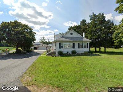
365 Monroeville Rd Monroeville, NJ 08343
Estimated Value: $366,275 - $399,000
--
Bed
--
Bath
--
Sq Ft
3.17
Acres
About This Home
This home is located at 365 Monroeville Rd, Monroeville, NJ 08343 and is currently estimated at $387,069. 365 Monroeville Rd is a home located in Salem County with nearby schools including Upper Pittsgrove School.
Ownership History
Date
Name
Owned For
Owner Type
Purchase Details
Closed on
Apr 14, 1998
Sold by
Cassaday Louis Ray and Cassaday Elizabeth A
Bought by
Cassaday Louis Ray and Cassaday Elizabeth A
Current Estimated Value
Home Financials for this Owner
Home Financials are based on the most recent Mortgage that was taken out on this home.
Original Mortgage
$89,700
Interest Rate
6.2%
Mortgage Type
Purchase Money Mortgage
Purchase Details
Closed on
Apr 7, 1998
Sold by
Cassaday Louis Ray and Cassaday Elizabeth A
Bought by
Cassaday Louis Ray and Cassaday Elizabeth A
Home Financials for this Owner
Home Financials are based on the most recent Mortgage that was taken out on this home.
Original Mortgage
$89,700
Interest Rate
6.2%
Mortgage Type
Purchase Money Mortgage
Create a Home Valuation Report for This Property
The Home Valuation Report is an in-depth analysis detailing your home's value as well as a comparison with similar homes in the area
Home Values in the Area
Average Home Value in this Area
Purchase History
| Date | Buyer | Sale Price | Title Company |
|---|---|---|---|
| Cassaday Louis Ray | -- | -- |
Source: Public Records
Mortgage History
| Date | Status | Borrower | Loan Amount |
|---|---|---|---|
| Open | Cassidy Louis Ray | $125,500 | |
| Closed | Cassaday Louis Ray | $120,500 | |
| Closed | Cassaday Louis Ray | $127,263 | |
| Closed | Cassaday Lou | $20,000 | |
| Closed | Cassaday Lou Ray | $81,000 | |
| Previous Owner | Cassaday Louis R | $73,057 | |
| Previous Owner | Cassaday Louis R | $28,000 | |
| Previous Owner | Cassaday Louis R | $6,000 | |
| Previous Owner | Cassaday Louis Ray | $89,700 |
Source: Public Records
Tax History Compared to Growth
Tax History
| Year | Tax Paid | Tax Assessment Tax Assessment Total Assessment is a certain percentage of the fair market value that is determined by local assessors to be the total taxable value of land and additions on the property. | Land | Improvement |
|---|---|---|---|---|
| 2024 | $7,742 | $259,700 | $67,300 | $192,400 |
| 2023 | $7,742 | $259,700 | $67,300 | $192,400 |
| 2022 | $7,570 | $259,700 | $67,300 | $192,400 |
| 2021 | $6,751 | $259,700 | $67,300 | $192,400 |
| 2020 | $7,072 | $259,700 | $67,300 | $192,400 |
| 2019 | $6,870 | $261,000 | $116,000 | $145,000 |
| 2018 | $6,559 | $261,000 | $116,000 | $145,000 |
| 2017 | $6,554 | $261,000 | $116,000 | $145,000 |
| 2016 | $6,267 | $261,000 | $116,000 | $145,000 |
| 2015 | $5,909 | $261,000 | $116,000 | $145,000 |
| 2014 | $5,708 | $261,000 | $116,000 | $145,000 |
Source: Public Records
Map
Nearby Homes
- 168 Friendship Rd
- 99 Three Bridge Rd
- 103 Friendship Rd
- 760 Buck Rd
- 0 Harding Hwy Unit NJSA2013586
- 88 Chestnut St
- 29 Church St
- 10 S Main St
- 104 S Main St
- 0 Garrison Rd Unit NJGL2052684
- 95 Park Ave
- 384 -386 Pine Tavern Rd
- 243 Broad St
- 25 Mimosa Ct
- 248 Harding Hwy
- 248 Unit C-10
- 430 Front St
- 316 Broad St
- 18 Spaulding Dr
- 550 Fennel Rd