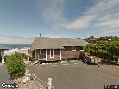
365 Monterey Dr Lincoln City, OR 97367
Coronado Shores NeighborhoodEstimated Value: $610,619 - $745,000
3
Beds
2
Baths
1,240
Sq Ft
$568/Sq Ft
Est. Value
About This Home
This home is located at 365 Monterey Dr, Lincoln City, OR 97367 and is currently estimated at $704,155, approximately $567 per square foot. 365 Monterey Dr is a home located in Lincoln County with nearby schools including Taft Elementary School, Oceanlake Elementary School, and Taft High School.
Ownership History
Date
Name
Owned For
Owner Type
Purchase Details
Closed on
Oct 31, 2017
Sold by
Woods Robert and Woods Maureen
Bought by
King Shawn
Current Estimated Value
Home Financials for this Owner
Home Financials are based on the most recent Mortgage that was taken out on this home.
Original Mortgage
$310,000
Outstanding Balance
$265,130
Interest Rate
3.83%
Mortgage Type
New Conventional
Estimated Equity
$427,737
Purchase Details
Closed on
Oct 21, 2005
Sold by
Wilson Dorothe M and Dorothe M Wilson Trust
Bought by
Woods Robert and Woods Maureen
Home Financials for this Owner
Home Financials are based on the most recent Mortgage that was taken out on this home.
Original Mortgage
$357,200
Interest Rate
5.67%
Mortgage Type
Purchase Money Mortgage
Create a Home Valuation Report for This Property
The Home Valuation Report is an in-depth analysis detailing your home's value as well as a comparison with similar homes in the area
Home Values in the Area
Average Home Value in this Area
Purchase History
| Date | Buyer | Sale Price | Title Company |
|---|---|---|---|
| King Shawn | $379,000 | Western Title & Escrow | |
| Woods Robert | $446,500 | Wte |
Source: Public Records
Mortgage History
| Date | Status | Borrower | Loan Amount |
|---|---|---|---|
| Open | King Shawn | $310,000 | |
| Previous Owner | Woods Robert | $332,224 | |
| Previous Owner | Woods Robert | $357,200 |
Source: Public Records
Tax History Compared to Growth
Tax History
| Year | Tax Paid | Tax Assessment Tax Assessment Total Assessment is a certain percentage of the fair market value that is determined by local assessors to be the total taxable value of land and additions on the property. | Land | Improvement |
|---|---|---|---|---|
| 2024 | $4,715 | $346,940 | -- | -- |
| 2023 | $4,307 | $336,840 | $0 | $0 |
| 2022 | $4,173 | $327,030 | $0 | $0 |
| 2021 | $4,067 | $317,510 | $0 | $0 |
| 2020 | $4,017 | $308,270 | $0 | $0 |
| 2019 | $3,715 | $299,300 | $0 | $0 |
| 2018 | $3,646 | $290,590 | $0 | $0 |
| 2017 | $3,533 | $282,130 | $0 | $0 |
| 2016 | $3,436 | $273,920 | $0 | $0 |
| 2015 | $3,340 | $265,950 | $0 | $0 |
| 2014 | -- | $258,210 | $0 | $0 |
| 2013 | -- | $250,690 | $0 | $0 |
Source: Public Records
Map
Nearby Homes
- 5371 El Mirador Way
- 5365 La Fiesta Way
- 265 Bunchberry Way
- 275 Coronado Dr
- 145 NW Lancer St
- 115 Ocean View St
- 158 Elderberry Way
- 150 Bella Beach Dr
- 5045 U S 101
- 5465 Palisades Dr
- 265 El Pueblo
- 4875 N Highway 101 Unit 93
- 4875 N Highway 101 Unit 46
- 4875 N Hwy 101 Unit 66
- 4875 N Hwy 101 Unit 46
- 4875 N Hwy 101 Unit 93
- 4875 N Hwy 101 Unit 92
- 5565 Palisades
- 115 Pacific St
- 35 Pacific St