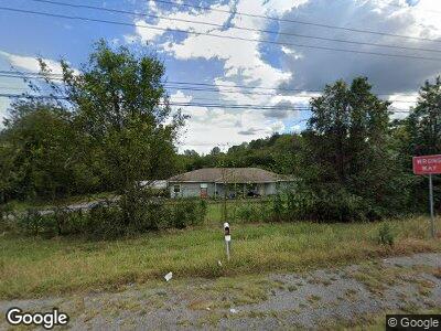
3684 Chatsworth Hwy Dalton, GA 30721
Estimated Value: $176,522 - $262,000
3
Beds
1
Bath
1,357
Sq Ft
$158/Sq Ft
Est. Value
About This Home
This home is located at 3684 Chatsworth Hwy, Dalton, GA 30721 and is currently estimated at $214,631, approximately $158 per square foot. 3684 Chatsworth Hwy is a home located in Whitfield County with nearby schools including Cedar Ridge Elementary School, Eastbrook Middle School, and Southeast Whitfield County High School.
Ownership History
Date
Name
Owned For
Owner Type
Purchase Details
Closed on
Jun 25, 2021
Sold by
Davis John E
Bought by
Sierra Properties Llc
Current Estimated Value
Purchase Details
Closed on
Sep 14, 2004
Sold by
Deutsche Bank Trust Company Am
Bought by
Davis John E
Purchase Details
Closed on
Aug 3, 2004
Sold by
Ridley Robert G
Bought by
Deutsche Bank Trust Company Americas
Purchase Details
Closed on
Sep 25, 2001
Sold by
Ridley Robert G and Ridley Marla K
Bought by
Ridley Robert G
Create a Home Valuation Report for This Property
The Home Valuation Report is an in-depth analysis detailing your home's value as well as a comparison with similar homes in the area
Home Values in the Area
Average Home Value in this Area
Purchase History
| Date | Buyer | Sale Price | Title Company |
|---|---|---|---|
| Sierra Properties Llc | -- | None Listed On Document | |
| Davis John E | $83,000 | -- | |
| Deutsche Bank Trust Company Americas | -- | -- | |
| Ridley Robert G | -- | -- |
Source: Public Records
Tax History Compared to Growth
Tax History
| Year | Tax Paid | Tax Assessment Tax Assessment Total Assessment is a certain percentage of the fair market value that is determined by local assessors to be the total taxable value of land and additions on the property. | Land | Improvement |
|---|---|---|---|---|
| 2024 | $907 | $46,027 | $9,287 | $36,740 |
| 2023 | $907 | $30,841 | $5,644 | $25,197 |
| 2022 | $678 | $22,978 | $4,608 | $18,370 |
| 2021 | $678 | $22,978 | $4,608 | $18,370 |
| 2020 | $701 | $22,978 | $4,608 | $18,370 |
| 2019 | $712 | $22,978 | $4,608 | $18,370 |
| 2018 | $714 | $22,650 | $4,280 | $18,370 |
| 2017 | $714 | $22,650 | $4,280 | $18,370 |
| 2016 | $608 | $20,042 | $3,292 | $16,750 |
| 2014 | $827 | $30,722 | $6,847 | $23,875 |
| 2013 | -- | $30,722 | $6,846 | $23,875 |
Source: Public Records
Map
Nearby Homes
- 0 Cheree Way Unit 129259
- 132 Cherokee Dr NE
- 0 Rollins Ketchum Rd
- 404 Lakeview Dr SE
- 282 Cedar Ridge Rd SE
- 210 Gordon Dr
- 8011 Starr Dr SE
- 185 Cedar Ridge Rd SE
- 63 Washington St
- 33 Washington St
- 43 Washington St
- 111 Arthur St
- 0 Leon Cir
- 4751 Tammy Dr NE
- 190 Rivers Edge Dr
- 502 Richardson Rd NE
- 3871 Miller Dr NE
- 0 Tibbs Bridge Rd SE
- 4119 Tibbs Bridge Rd SE
- 185 Cedar Ridge Rd