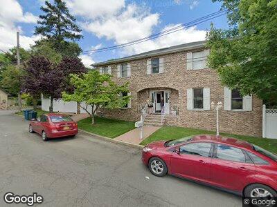
37 Reiss Ln Staten Island, NY 10304
Dongan Hills NeighborhoodEstimated Value: $1,452,479 - $1,820,000
--
Bed
--
Bath
3,060
Sq Ft
$549/Sq Ft
Est. Value
About This Home
This home is located at 37 Reiss Ln, Staten Island, NY 10304 and is currently estimated at $1,679,370, approximately $548 per square foot. 37 Reiss Ln is a home located in Richmond County with nearby schools including P.S. 11 Thomas Dongan School, Myra S. Barnes Intermediate School 24, and Susan E Wagner High School.
Ownership History
Date
Name
Owned For
Owner Type
Purchase Details
Closed on
Aug 31, 1999
Sold by
Moretti Anthony J and Moretti Laura J
Bought by
Moretti Laura J
Current Estimated Value
Purchase Details
Closed on
Oct 23, 1996
Sold by
Scura Joseph C and Scura Gloria A
Bought by
Moretti Anthony J and Moretti Laura J
Home Financials for this Owner
Home Financials are based on the most recent Mortgage that was taken out on this home.
Original Mortgage
$440,000
Interest Rate
7.81%
Create a Home Valuation Report for This Property
The Home Valuation Report is an in-depth analysis detailing your home's value as well as a comparison with similar homes in the area
Home Values in the Area
Average Home Value in this Area
Purchase History
| Date | Buyer | Sale Price | Title Company |
|---|---|---|---|
| Moretti Laura J | -- | Chicago Title Insurance Co | |
| Moretti Anthony J | $550,000 | -- |
Source: Public Records
Mortgage History
| Date | Status | Borrower | Loan Amount |
|---|---|---|---|
| Open | Moretti Laura | $404,500 | |
| Closed | Moretti Laura J | $105,470 | |
| Closed | Moretti Anthony J | $936 | |
| Closed | Moretti Anthony J | $440,000 |
Source: Public Records
Tax History Compared to Growth
Tax History
| Year | Tax Paid | Tax Assessment Tax Assessment Total Assessment is a certain percentage of the fair market value that is determined by local assessors to be the total taxable value of land and additions on the property. | Land | Improvement |
|---|---|---|---|---|
| 2024 | $13,604 | $77,580 | $22,756 | $54,824 |
| 2023 | $12,949 | $65,160 | $18,274 | $46,886 |
| 2022 | $12,721 | $87,780 | $25,560 | $62,220 |
| 2021 | $13,307 | $79,320 | $25,560 | $53,760 |
| 2020 | $12,618 | $69,840 | $25,560 | $44,280 |
| 2019 | $11,748 | $60,720 | $25,560 | $35,160 |
| 2018 | $10,771 | $54,300 | $25,560 | $28,740 |
| 2017 | $11,498 | $57,876 | $23,798 | $34,078 |
| 2016 | $10,605 | $54,600 | $25,560 | $29,040 |
| 2015 | $9,459 | $53,932 | $19,944 | $33,988 |
| 2014 | $9,459 | $50,880 | $21,300 | $29,580 |
Source: Public Records
Map
Nearby Homes
- 40 Francis Place
- 21 Francis Place
- 38 Oakdale Ave
- 210 Spring St Unit 5
- 210 Spring St Unit 5 FL
- 22 Duncan St
- 480 Ocean Terrace
- 179 Mason St
- 33 Emerson Ct
- 124 Dutchess Ave
- 78 Mason St
- 200 Coverly Ave
- 25 Coverly Ave
- 26 Emerson Ave
- 96 Circle Rd
- 67 Sparkill Ave
- 15 Midway Place
- 1373 Richmond Rd
- 60 Lyman Place
- 0 Overlook Ave