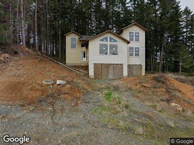
370 Boulder Ridge Dr Unit 16 Sweet Home, OR 97386
Estimated Value: $373,611 - $374,000
4
Beds
5
Baths
3,011
Sq Ft
$124/Sq Ft
Est. Value
About This Home
This home is located at 370 Boulder Ridge Dr Unit 16, Sweet Home, OR 97386 and is currently estimated at $373,806, approximately $124 per square foot. 370 Boulder Ridge Dr Unit 16 is a home located in Linn County with nearby schools including Sweet Home High School, Little Promises Children's Program, and East Linn Christian Academy Elementary-Liberty Campus.
Ownership History
Date
Name
Owned For
Owner Type
Purchase Details
Closed on
Apr 8, 2022
Sold by
Anthony Mcgovern
Bought by
Hemenway Alan and Hemenway Judith
Current Estimated Value
Purchase Details
Closed on
Nov 25, 2020
Sold by
Terra Firma Property Development Inc
Bought by
Mcgovern Anthony
Home Financials for this Owner
Home Financials are based on the most recent Mortgage that was taken out on this home.
Original Mortgage
$40,000
Interest Rate
2.8%
Mortgage Type
Commercial
Purchase Details
Closed on
May 26, 2011
Sold by
Comanche Moon Llc
Bought by
Pioneer Trust Bank N A
Create a Home Valuation Report for This Property
The Home Valuation Report is an in-depth analysis detailing your home's value as well as a comparison with similar homes in the area
Home Values in the Area
Average Home Value in this Area
Purchase History
| Date | Buyer | Sale Price | Title Company |
|---|---|---|---|
| Hemenway Alan | $60,000 | First American Title | |
| Mcgovern Anthony | $45,000 | Fidelity National Title | |
| Pioneer Trust Bank N A | $4,866,942 | Amerititle |
Source: Public Records
Mortgage History
| Date | Status | Borrower | Loan Amount |
|---|---|---|---|
| Previous Owner | Mcgovern Anthony | $40,000 |
Source: Public Records
Tax History Compared to Growth
Tax History
| Year | Tax Paid | Tax Assessment Tax Assessment Total Assessment is a certain percentage of the fair market value that is determined by local assessors to be the total taxable value of land and additions on the property. | Land | Improvement |
|---|---|---|---|---|
| 2024 | $3,744 | $151,280 | -- | -- |
| 2023 | $968 | $46,530 | $46,530 | $0 |
| 2022 | $789 | $45,180 | $0 | $0 |
| 2021 | $704 | $41,550 | $0 | $0 |
| 2020 | $803 | $43,870 | $0 | $0 |
| 2019 | $699 | $41,030 | $0 | $0 |
| 2018 | $637 | $37,360 | $0 | $0 |
| 2017 | $502 | $29,380 | $0 | $0 |
| 2016 | $490 | $28,800 | $0 | $0 |
| 2015 | $560 | $32,590 | $0 | $0 |
| 2014 | $661 | $38,400 | $0 | $0 |
Source: Public Records
Map
Nearby Homes
- 370 Boulder Ridge Dr
- 360 Boulder Ridge Dr
- 280 Boulder Ridge Dr
- 924 Park St
- 985 Pinetop St
- 140 7th Ave
- 940 Cedar St
- 920 Dogwood St
- 953 Grape St
- 220 21st (Next To Lot Unit 3900) Av
- 220 21st (Next To Lot Unit 3903) Av
- 0 Tax Lot 500 Unit 720138119
- 220 21st Lot 3903 (Next
- 520 14th Ave
- 26919 Old Holley Rd
- 2076 Cedar St
- 712 12th (-722) Ave
- TL2500 Grape St
- 611 3rd Ave
- 1650 Fir St