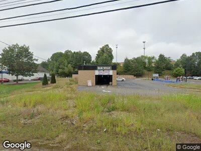
376 Daniel Webster Hwy MerriMacK, NH 03054
Merrimack NeighborhoodEstimated Value: $1,699,905
--
Bed
1
Bath
3,700
Sq Ft
$459/Sq Ft
Est. Value
About This Home
This home is located at 376 Daniel Webster Hwy, MerriMacK, NH 03054 and is currently estimated at $1,699,905, approximately $459 per square foot. 376 Daniel Webster Hwy is a home located in Hillsborough County with nearby schools including Thorntons Ferry School, James Mastricola Upper Elementary School, and Merrimack Middle School.
Ownership History
Date
Name
Owned For
Owner Type
Purchase Details
Closed on
Mar 9, 2021
Sold by
376 Dw Hwy Llc
Bought by
Staraten Realty Llc
Current Estimated Value
Home Financials for this Owner
Home Financials are based on the most recent Mortgage that was taken out on this home.
Original Mortgage
$1,000,000
Interest Rate
2.7%
Mortgage Type
Purchase Money Mortgage
Purchase Details
Closed on
Feb 10, 2016
Sold by
Haileyesus Samson
Bought by
376 Dw Hwy Llc
Create a Home Valuation Report for This Property
The Home Valuation Report is an in-depth analysis detailing your home's value as well as a comparison with similar homes in the area
Home Values in the Area
Average Home Value in this Area
Purchase History
| Date | Buyer | Sale Price | Title Company |
|---|---|---|---|
| Staraten Realty Llc | $1,300,000 | None Available | |
| 376 Dw Hwy Llc | $428,000 | -- |
Source: Public Records
Mortgage History
| Date | Status | Borrower | Loan Amount |
|---|---|---|---|
| Open | Starten Realty Llc | $800,000 | |
| Closed | Staraten Realty Llc | $1,000,000 | |
| Previous Owner | 376 Dw Hwy Llc | $428,000 | |
| Previous Owner | Kane Carol A | $185,000 | |
| Previous Owner | Kane Carol A | $40,000 |
Source: Public Records
Tax History Compared to Growth
Tax History
| Year | Tax Paid | Tax Assessment Tax Assessment Total Assessment is a certain percentage of the fair market value that is determined by local assessors to be the total taxable value of land and additions on the property. | Land | Improvement |
|---|---|---|---|---|
| 2023 | $14,574 | $749,300 | $460,100 | $289,200 |
| 2022 | $15,997 | $920,400 | $460,100 | $460,300 |
| 2021 | $15,803 | $920,400 | $460,100 | $460,300 |
| 2020 | $10,401 | $432,300 | $256,100 | $176,200 |
| 2019 | $10,431 | $432,300 | $256,100 | $176,200 |
| 2018 | $10,233 | $432,300 | $256,100 | $176,200 |
| 2017 | $10,103 | $432,300 | $256,100 | $176,200 |
| 2016 | $9,852 | $432,300 | $256,100 | $176,200 |
| 2015 | $10,348 | $418,600 | $233,100 | $185,500 |
| 2014 | $10,084 | $418,600 | $233,100 | $185,500 |
| 2013 | $10,009 | $418,600 | $233,100 | $185,500 |
Source: Public Records
Map
Nearby Homes
- 5 E Ridge Rd Unit A
- 5 E Ridge Rd
- 46 Pondview Dr
- 15 Echo Shore Dr
- 7 Den Ave
- 490 Charles Bancroft Hwy
- 11 Turnbuckle Ln
- 121 Herrick St
- 14 Turnbuckle Ln Unit 31
- 14 Turnbuckle Ln Unit 37
- 34 Currier Rd
- 82 Old Stage Rd
- 9 Buttonwood Ln
- 1 Longwood Ln
- 87 Sentry Way
- 2 Concord Coach Ln
- 6 Whitetail Ridge
- 31 Camp Sargent Rd
- 12 Conifer St
- 35 Windsor Dr Unit A