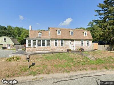
379 Market St Swansea, MA 02777
North Swansea NeighborhoodEstimated Value: $534,000 - $612,000
4
Beds
2
Baths
2,056
Sq Ft
$276/Sq Ft
Est. Value
About This Home
This home is located at 379 Market St, Swansea, MA 02777 and is currently estimated at $566,446, approximately $275 per square foot. 379 Market St is a home located in Bristol County with nearby schools including Joseph Case High School, Highlander Charter Middle and High School, and East Bay Career Academy.
Ownership History
Date
Name
Owned For
Owner Type
Purchase Details
Closed on
Jan 9, 2018
Sold by
Yott Jennifer A and Yott Patrick M
Bought by
Ferguson Emma and Ferguson Justin
Current Estimated Value
Home Financials for this Owner
Home Financials are based on the most recent Mortgage that was taken out on this home.
Original Mortgage
$255,494
Interest Rate
3.75%
Mortgage Type
FHA
Purchase Details
Closed on
Aug 21, 2003
Sold by
Duval Joanne F and Duval Kenneth
Bought by
Yott Jennifer A and Yott Patrick M
Home Financials for this Owner
Home Financials are based on the most recent Mortgage that was taken out on this home.
Original Mortgage
$233,100
Interest Rate
5.52%
Mortgage Type
Purchase Money Mortgage
Purchase Details
Closed on
Dec 19, 1995
Sold by
Scullane John T and Bromberg Amy L
Bought by
Duval Kenneth and Duval Joanne F
Home Financials for this Owner
Home Financials are based on the most recent Mortgage that was taken out on this home.
Original Mortgage
$117,587
Interest Rate
7.43%
Mortgage Type
Purchase Money Mortgage
Create a Home Valuation Report for This Property
The Home Valuation Report is an in-depth analysis detailing your home's value as well as a comparison with similar homes in the area
Home Values in the Area
Average Home Value in this Area
Purchase History
| Date | Buyer | Sale Price | Title Company |
|---|---|---|---|
| Ferguson Emma | $279,000 | -- | |
| Yott Jennifer A | $259,000 | -- | |
| Duval Kenneth | $130,000 | -- |
Source: Public Records
Mortgage History
| Date | Status | Borrower | Loan Amount |
|---|---|---|---|
| Open | Ferguson Justin | $30,000 | |
| Open | Ferguson Justin | $278,500 | |
| Closed | Ferguson Emma | $268,800 | |
| Closed | Ferguson Emma | $255,494 | |
| Previous Owner | Yott Jennifer A | $233,100 | |
| Previous Owner | Duval Kenneth | $8,000 | |
| Previous Owner | Duval Kenneth | $117,587 |
Source: Public Records
Tax History Compared to Growth
Tax History
| Year | Tax Paid | Tax Assessment Tax Assessment Total Assessment is a certain percentage of the fair market value that is determined by local assessors to be the total taxable value of land and additions on the property. | Land | Improvement |
|---|---|---|---|---|
| 2024 | $4,976 | $415,000 | $182,000 | $233,000 |
| 2023 | $4,576 | $348,500 | $134,900 | $213,600 |
| 2022 | $4,321 | $300,300 | $123,200 | $177,100 |
| 2021 | $7,891 | $279,600 | $123,200 | $156,400 |
| 2020 | $4,306 | $276,400 | $123,200 | $153,200 |
| 2019 | $4,225 | $272,400 | $110,600 | $161,800 |
| 2018 | $4,702 | $260,900 | $108,900 | $152,000 |
| 2017 | $3,442 | $259,200 | $108,900 | $150,300 |
| 2016 | $3,196 | $236,400 | $94,600 | $141,800 |
| 2015 | $3,100 | $236,100 | $94,600 | $141,500 |
| 2014 | $2,899 | $225,800 | $94,600 | $131,200 |
Source: Public Records
Map
Nearby Homes
- 362 Market St
- 356 Old Fall River Rd
- 47 Barneyville Rd
- 196 Bushee Rd
- 0 Birch Swamp Rd Unit 1374443
- 20 Burr Ave
- 192 Schoolhouse Rd
- 6 Christine Dr
- 69 Glenwood Dr
- 1 Tall Pines Dr
- 2 Palmer St
- 62 Linden Rd
- 0 Community Ln (Ss)
- 15 Thompson St
- 11 Union St
- 21 Davis St
- 8 William St
- 9 Meadow St
- 510 Child St Unit 311A
- 510 Child St Unit 101B