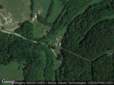
37991 Skinner Grimes Rd Jerusalem, OH 43747
Estimated Value: $328,000 - $403,000
5
Beds
3
Baths
2,880
Sq Ft
$123/Sq Ft
Est. Value
About This Home
This home is located at 37991 Skinner Grimes Rd, Jerusalem, OH 43747 and is currently estimated at $354,666, approximately $123 per square foot. 37991 Skinner Grimes Rd is a home with nearby schools including Barnesville Elementary School, Barnesville Middle School, and Barnesville High School.
Ownership History
Date
Name
Owned For
Owner Type
Purchase Details
Closed on
Mar 29, 2011
Sold by
Groves Denise
Bought by
Groves Michael J
Current Estimated Value
Purchase Details
Closed on
Oct 1, 2002
Sold by
Groves Michael J and Groves Denise
Bought by
Groves Michael J and Groves Denise
Purchase Details
Closed on
May 20, 1998
Sold by
Groves Lois M
Bought by
Groves Lois M
Purchase Details
Closed on
Jan 1, 1986
Sold by
Groves Rodger A and Groves Lois M
Bought by
Groves Rodger A and Groves Lois M
Create a Home Valuation Report for This Property
The Home Valuation Report is an in-depth analysis detailing your home's value as well as a comparison with similar homes in the area
Home Values in the Area
Average Home Value in this Area
Purchase History
| Date | Buyer | Sale Price | Title Company |
|---|---|---|---|
| Groves Michael J | -- | Attorney | |
| Groves Michael J | -- | -- | |
| Groves Lois M | -- | -- | |
| Groves Rodger A | -- | -- |
Source: Public Records
Mortgage History
| Date | Status | Borrower | Loan Amount |
|---|---|---|---|
| Open | Groves Michael J | $30,000 | |
| Open | Groves Michael J | $150,000 |
Source: Public Records
Tax History Compared to Growth
Tax History
| Year | Tax Paid | Tax Assessment Tax Assessment Total Assessment is a certain percentage of the fair market value that is determined by local assessors to be the total taxable value of land and additions on the property. | Land | Improvement |
|---|---|---|---|---|
| 2024 | $3,423 | $109,810 | $23,250 | $86,560 |
| 2023 | $3,048 | $93,730 | $19,120 | $74,610 |
| 2022 | $3,046 | $93,726 | $19,120 | $74,606 |
| 2021 | $3,055 | $93,722 | $19,120 | $74,602 |
| 2020 | $2,760 | $81,500 | $16,630 | $64,870 |
| 2019 | $2,762 | $81,500 | $16,630 | $64,870 |
| 2018 | $2,629 | $81,500 | $16,630 | $64,870 |
| 2017 | $2,500 | $72,330 | $14,690 | $57,640 |
| 2016 | $2,436 | $72,330 | $14,690 | $57,640 |
| 2015 | $1,030 | $30,510 | $14,280 | $16,230 |
| 2014 | $1,010 | $29,580 | $13,350 | $16,230 |
| 2013 | $1,016 | $29,580 | $13,350 | $16,230 |
Source: Public Records
Map
Nearby Homes
- 55480 Washington St
- 55541 Washington St
- 55484 Robin Dr
- 53525 Somerton Hwy
- 57128 Somerton Hwy
- 0 State Route 145
- 0 W (Wilson) Dr
- 0 W (Lot 24 Block D) Rear (Wilson) Dr Unit 5058960
- 0 W (Lot 23 Block D) Rear (Wilson) Dr Unit 5058961
- 0 W (Lot 22 Block D) Rear (Wilson) Dr Unit 5058962
- 0 W (Lot 21 Block D) Rear (Wilson) Dr Unit 5058964
- 0 W (Lot 20 Block D) Rear (Wilson) Dr Unit 5058965
- 0 E (Lot 28 Block D) Rear (Wilson) Dr Unit 5058956
- 0 E (Lot 27 Block D) Rear (Wilson) Dr
- 0 E (Lot 43 Block D) (Wilson) Dr Unit 5058856
- 0 E (Lot 17 Block D) (Wilson) Dr Unit 5058849
- 0 W (Lot 15 Block F) (Wilson) Dr Unit 5058858
- 0 W (Lot 14 Block F) Rear (Wilson) Dr Unit 5058946
- 0 E (Lot 26 Block D) Rear (Wilson) Dr Unit 5058958
- 0 E (Lot 25 Block D) Rear (Wilson) Dr Unit 5058959
