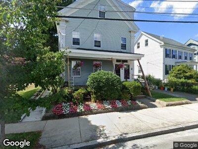
38 Sprague St Malden, MA 02148
Malden Center NeighborhoodEstimated Value: $836,000 - $1,030,997
5
Beds
3
Baths
3,324
Sq Ft
$292/Sq Ft
Est. Value
About This Home
This home is located at 38 Sprague St, Malden, MA 02148 and is currently estimated at $972,249, approximately $292 per square foot. 38 Sprague St is a home located in Middlesex County with nearby schools including Malden High School, Mystic Valley Regional Charter School, and Cheverus Catholic School.
Ownership History
Date
Name
Owned For
Owner Type
Purchase Details
Closed on
Dec 28, 2022
Sold by
Bronder-Giroux Philip A and Bronder-Giroux Pamela R
Bought by
Sunshine Leo P and Bronder-Giroux Lucien E
Current Estimated Value
Purchase Details
Closed on
Apr 26, 1996
Sold by
Bronder-Giroux Pamela and Bronder-Giroux Philip
Bought by
Bronder-Giroux Pamela and Bronder-Giroux Philip
Home Financials for this Owner
Home Financials are based on the most recent Mortgage that was taken out on this home.
Original Mortgage
$180,000
Interest Rate
7.81%
Mortgage Type
Purchase Money Mortgage
Create a Home Valuation Report for This Property
The Home Valuation Report is an in-depth analysis detailing your home's value as well as a comparison with similar homes in the area
Home Values in the Area
Average Home Value in this Area
Purchase History
| Date | Buyer | Sale Price | Title Company |
|---|---|---|---|
| Sunshine Leo P | -- | None Available | |
| Bronder-Giroux Pamela | $90,000 | -- | |
| Bronder-Giroux Pamela | $90,000 | -- |
Source: Public Records
Mortgage History
| Date | Status | Borrower | Loan Amount |
|---|---|---|---|
| Previous Owner | Bronder-Giroux Philip A | $165,000 | |
| Previous Owner | Bronder-Giroux Philip A | $35,000 | |
| Previous Owner | Bronder-Giroux Pamela | $100,000 | |
| Previous Owner | Bronder-Giroux Pamela | $20,000 | |
| Previous Owner | Bronder-Giroux Pamela | $195,000 | |
| Previous Owner | Bronder-Giroux Pamela | $180,000 |
Source: Public Records
Tax History Compared to Growth
Tax History
| Year | Tax Paid | Tax Assessment Tax Assessment Total Assessment is a certain percentage of the fair market value that is determined by local assessors to be the total taxable value of land and additions on the property. | Land | Improvement |
|---|---|---|---|---|
| 2025 | $107 | $944,900 | $298,100 | $646,800 |
| 2024 | $10,406 | $890,200 | $282,000 | $608,200 |
| 2023 | $10,043 | $823,900 | $257,800 | $566,100 |
| 2022 | $9,370 | $758,700 | $233,600 | $525,100 |
| 2021 | $9,077 | $738,600 | $213,500 | $525,100 |
| 2020 | $8,741 | $691,000 | $203,000 | $488,000 |
| 2019 | $8,312 | $626,400 | $193,300 | $433,100 |
| 2018 | $8,050 | $571,300 | $163,100 | $408,200 |
| 2017 | $7,813 | $551,400 | $163,100 | $388,300 |
| 2016 | $6,787 | $447,700 | $155,100 | $292,600 |
| 2015 | $6,452 | $410,200 | $146,200 | $264,000 |
| 2014 | $5,967 | $370,600 | $132,900 | $237,700 |
Source: Public Records
Map
Nearby Homes
- 58 Clark St
- 61 Washington St Unit D
- 244 Salem St Unit 15
- 49 Clifton St
- 785 Main St Unit 3
- 28-30 Holyoke St
- 32 Lynde St
- 25 Coburn St
- 5 High St
- 18 Newhall St
- 15 Bowers Ave Unit 1
- 20 Chestnut St Unit 201
- 20 Chestnut St Unit 304
- 20 Daniels St Unit 101
- 2 Rocky Nook Unit 2
- 3 Goodwin Ave
- 30 Daniels St Unit 313
- 30 Daniels St Unit 203
- 72 Ashland St Unit 107
- 95-99 Maple St Unit 20