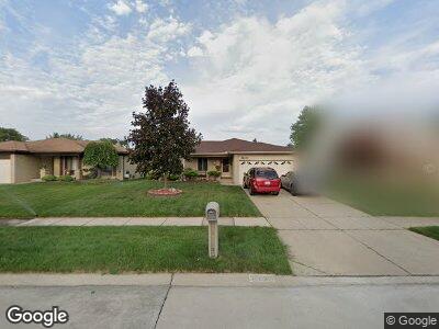
38030 Steede Dr Sterling Heights, MI 48310
Estimated Value: $308,646 - $327,000
--
Bed
--
Bath
1,428
Sq Ft
$223/Sq Ft
Est. Value
About This Home
This home is located at 38030 Steede Dr, Sterling Heights, MI 48310 and is currently estimated at $318,412, approximately $222 per square foot. 38030 Steede Dr is a home located in Macomb County with nearby schools including Holden Elementary School, Grissom Middle School, and Sterling Heights Senior H.S..
Ownership History
Date
Name
Owned For
Owner Type
Purchase Details
Closed on
Nov 6, 2003
Sold by
Moore Ronald G and Moore Sharon D
Bought by
Moore Ronald G and Moore Sharon D
Current Estimated Value
Home Financials for this Owner
Home Financials are based on the most recent Mortgage that was taken out on this home.
Original Mortgage
$47,850
Interest Rate
6.04%
Mortgage Type
Stand Alone Second
Purchase Details
Closed on
Oct 2, 1998
Sold by
Dahl Kenneth
Bought by
Moore Ronald G
Create a Home Valuation Report for This Property
The Home Valuation Report is an in-depth analysis detailing your home's value as well as a comparison with similar homes in the area
Home Values in the Area
Average Home Value in this Area
Purchase History
| Date | Buyer | Sale Price | Title Company |
|---|---|---|---|
| Moore Ronald G | -- | Title Source Inc | |
| Moore Ronald G | -- | Title Source Inc | |
| Moore Ronald G | $167,900 | -- |
Source: Public Records
Mortgage History
| Date | Status | Borrower | Loan Amount |
|---|---|---|---|
| Open | Moore Ronald G | $107,000 | |
| Closed | Moore Ronald G | $110,000 | |
| Closed | Moore Ronald G | $47,850 | |
| Closed | Moore Ronald G | $145,000 |
Source: Public Records
Tax History Compared to Growth
Tax History
| Year | Tax Paid | Tax Assessment Tax Assessment Total Assessment is a certain percentage of the fair market value that is determined by local assessors to be the total taxable value of land and additions on the property. | Land | Improvement |
|---|---|---|---|---|
| 2024 | $3,005 | $142,300 | $0 | $0 |
| 2023 | $2,852 | $130,700 | $0 | $0 |
| 2022 | $2,766 | $118,100 | $0 | $0 |
| 2021 | $2,859 | $113,900 | $0 | $0 |
| 2020 | $2,718 | $108,300 | $0 | $0 |
| 2019 | $2,679 | $101,500 | $0 | $0 |
| 2018 | $2,701 | $90,500 | $0 | $0 |
| 2017 | $2,606 | $85,600 | $13,500 | $72,100 |
| 2016 | $2,551 | $85,600 | $0 | $0 |
| 2015 | -- | $79,900 | $0 | $0 |
| 2014 | -- | $64,800 | $0 | $0 |
Source: Public Records
Map
Nearby Homes
- 4287 Fox Hill Dr
- 4238 Gloucester Dr
- 3601 Denson Dr
- 3043 Fox Hill Dr
- 3238 Donna Dr
- 37300 Hanson Dr
- 37336 Hanson Dr
- 4421 Ardmore Dr
- 2938 Fox Hill Dr
- 3411 Leason Rd
- 3038 Donna Dr
- 2848 Reese Dr
- 2911 Groves Dr
- 3008 Albany Dr
- 39102 Faith Dr
- 39588 Dequindre Rd
- 37130 Gary Dr
- 36754 Iroquois Dr
- 39392 Owendale Dr
- 38983 Fairfield Dr