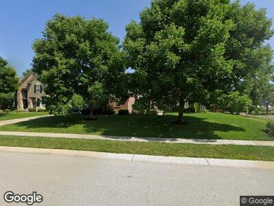
3846 Castle Rock Dr Zionsville, IN 46077
West Carmel NeighborhoodEstimated Value: $722,576 - $813,000
5
Beds
4
Baths
4,401
Sq Ft
$176/Sq Ft
Est. Value
About This Home
This home is located at 3846 Castle Rock Dr, Zionsville, IN 46077 and is currently estimated at $773,644, approximately $175 per square foot. 3846 Castle Rock Dr is a home located in Hamilton County with nearby schools including Towne Meadow Elementary School, Creekside Middle School, and Carmel High School.
Ownership History
Date
Name
Owned For
Owner Type
Purchase Details
Closed on
Sep 20, 2004
Sold by
Eastwood Michael D and Eastwood Cynthia M
Bought by
Gill Edward and Gill Marisa A
Current Estimated Value
Home Financials for this Owner
Home Financials are based on the most recent Mortgage that was taken out on this home.
Original Mortgage
$341,000
Interest Rate
4.75%
Mortgage Type
Purchase Money Mortgage
Purchase Details
Closed on
Jun 27, 2003
Sold by
Pulte Homes Of Indiana Llc
Bought by
Eastwood Michael D and Eastwood Cynthia M
Home Financials for this Owner
Home Financials are based on the most recent Mortgage that was taken out on this home.
Original Mortgage
$197,000
Interest Rate
5.36%
Mortgage Type
Purchase Money Mortgage
Create a Home Valuation Report for This Property
The Home Valuation Report is an in-depth analysis detailing your home's value as well as a comparison with similar homes in the area
Home Values in the Area
Average Home Value in this Area
Purchase History
| Date | Buyer | Sale Price | Title Company |
|---|---|---|---|
| Gill Edward | -- | -- | |
| Eastwood Michael D | -- | -- |
Source: Public Records
Mortgage History
| Date | Status | Borrower | Loan Amount |
|---|---|---|---|
| Open | Gill Edward | $210,500 | |
| Closed | Gill Edward | $225,060 | |
| Closed | Gill Edward | $341,000 | |
| Previous Owner | Eastwood Michael D | $197,000 | |
| Closed | Gill Edward | $48,200 |
Source: Public Records
Tax History Compared to Growth
Tax History
| Year | Tax Paid | Tax Assessment Tax Assessment Total Assessment is a certain percentage of the fair market value that is determined by local assessors to be the total taxable value of land and additions on the property. | Land | Improvement |
|---|---|---|---|---|
| 2024 | $6,898 | $648,800 | $147,000 | $501,800 |
| 2023 | $6,963 | $618,300 | $110,500 | $507,800 |
| 2022 | $6,013 | $526,200 | $110,500 | $415,700 |
| 2021 | $5,077 | $443,000 | $110,500 | $332,500 |
| 2020 | $4,567 | $404,200 | $110,500 | $293,700 |
| 2019 | $4,581 | $405,400 | $80,200 | $325,200 |
| 2018 | $4,242 | $377,200 | $80,200 | $297,000 |
| 2017 | $4,228 | $376,000 | $80,200 | $295,800 |
| 2016 | $4,240 | $382,800 | $80,200 | $302,600 |
| 2014 | $3,942 | $361,700 | $74,400 | $287,300 |
| 2013 | $3,942 | $364,900 | $74,400 | $290,500 |
Source: Public Records
Map
Nearby Homes
- 3926 Castle Rock Dr
- 11367 Zanardi Ct
- 12030 Auburn Creek Crossing
- 11710 Cold Creek Ct
- 4287 Prairie Falcon Dr
- 3747 W 121st St
- 4212 Stone Lake Dr
- 3733 W 121st St
- 4248 Stone Lake Dr
- 10889 Weston Dr
- 3715 Kendall Wood Dr
- 4514 Golden Eagle Ct
- 10827 Putnam Place
- 3841 Constitution Dr
- 3856 Cornwallis Ln
- 11796 Sycamore St
- 3497 Sedgemoor Cir
- 3370 Walnut Creek Ct
- 11730 Ansley Ct
- 11640 Ansley Ct
