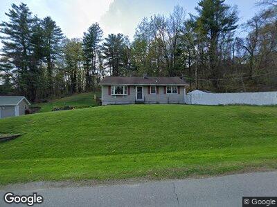
39 Northline Dr Melrose, NY 12121
Estimated Value: $248,000 - $292,000
3
Beds
1
Bath
1,292
Sq Ft
$206/Sq Ft
Est. Value
About This Home
This home is located at 39 Northline Dr, Melrose, NY 12121 and is currently estimated at $265,871, approximately $205 per square foot. 39 Northline Dr is a home located in Rensselaer County with nearby schools including Hoosic Valley Elementary School and Hoosic Valley Junior/Senior High School.
Ownership History
Date
Name
Owned For
Owner Type
Purchase Details
Closed on
Mar 27, 2025
Sold by
Whitford Brittany and Bombard Zachary
Bought by
Clark Andrew and Lambert Sadie
Current Estimated Value
Home Financials for this Owner
Home Financials are based on the most recent Mortgage that was taken out on this home.
Original Mortgage
$290,638
Outstanding Balance
$290,638
Interest Rate
6.87%
Mortgage Type
FHA
Estimated Equity
-$24,767
Purchase Details
Closed on
Nov 30, 2020
Sold by
Bernacki Michael S and Bernacki Mary J
Bought by
Bombard Zachary and Whitford Brittany
Home Financials for this Owner
Home Financials are based on the most recent Mortgage that was taken out on this home.
Original Mortgage
$174,600
Interest Rate
2.8%
Mortgage Type
New Conventional
Create a Home Valuation Report for This Property
The Home Valuation Report is an in-depth analysis detailing your home's value as well as a comparison with similar homes in the area
Home Values in the Area
Average Home Value in this Area
Purchase History
| Date | Buyer | Sale Price | Title Company |
|---|---|---|---|
| Clark Andrew | $296,000 | None Available | |
| Bombard Zachary | $180,000 | None Available | |
| Bombard Zachary | $180,000 | None Available |
Source: Public Records
Mortgage History
| Date | Status | Borrower | Loan Amount |
|---|---|---|---|
| Open | Clark Andrew | $290,638 | |
| Previous Owner | Bombard Zachary | $174,600 | |
| Previous Owner | Bernacki Michael S | $91,658 | |
| Previous Owner | Bernacki Michael S | $75,000 |
Source: Public Records
Tax History Compared to Growth
Tax History
| Year | Tax Paid | Tax Assessment Tax Assessment Total Assessment is a certain percentage of the fair market value that is determined by local assessors to be the total taxable value of land and additions on the property. | Land | Improvement |
|---|---|---|---|---|
| 2024 | $6,021 | $45,000 | $10,200 | $34,800 |
| 2023 | $6,021 | $45,000 | $10,200 | $34,800 |
| 2022 | $5,904 | $45,000 | $10,200 | $34,800 |
| 2021 | $5,575 | $45,000 | $10,200 | $34,800 |
| 2020 | $5,209 | $45,000 | $10,200 | $34,800 |
| 2019 | $5,238 | $45,000 | $10,200 | $34,800 |
| 2018 | $5,238 | $45,000 | $10,200 | $34,800 |
| 2017 | $5,203 | $45,000 | $10,200 | $34,800 |
| 2016 | $5,134 | $45,000 | $10,200 | $34,800 |
| 2015 | -- | $45,000 | $10,200 | $34,800 |
| 2014 | -- | $45,000 | $10,200 | $34,800 |
Source: Public Records
Map
Nearby Homes
- L11.2 Millard Rd
- 0 Millard Rd Unit 155047
- 897 New York 40
- 1292 State Route 40
- 987 Valley Falls Rd
- 140 Turner Rd
- 4 Ribbon Candy Ln
- L4 Fogarty Rd
- 42 Ashcroft Rd
- 19 Brundige Rd
- 2650 River Rd
- 0 Beverly Rd
- 193 Brundige Rd
- 1850 State Route 67
- 57 Lake Shore Dr
- 2256 State Highway 7
- L27.11 Otter Creek Rd
- 175 New Turnpike Rd
- 4 Bennington Ave
- 311 Belgrade St