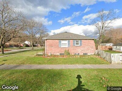
3902 Custer Ave Royal Oak, MI 48073
Estimated Value: $296,000 - $348,000
3
Beds
2
Baths
1,000
Sq Ft
$312/Sq Ft
Est. Value
About This Home
This home is located at 3902 Custer Ave, Royal Oak, MI 48073 and is currently estimated at $311,704, approximately $311 per square foot. 3902 Custer Ave is a home located in Oakland County with nearby schools including Addams Elementary, Royal Oak Middle School, and Royal Oak High School.
Ownership History
Date
Name
Owned For
Owner Type
Purchase Details
Closed on
Oct 20, 2022
Sold by
Colling Nanette
Bought by
Nanette Colling Trust
Current Estimated Value
Purchase Details
Closed on
Nov 9, 2021
Sold by
Drem Llc
Bought by
Colling Nanette
Purchase Details
Closed on
Jun 11, 2020
Sold by
Wayne Lori C and Shand Lori C
Bought by
Drem Llc
Purchase Details
Closed on
Aug 19, 2005
Sold by
Whiteside James S
Bought by
Shand Lori C
Home Financials for this Owner
Home Financials are based on the most recent Mortgage that was taken out on this home.
Original Mortgage
$164,950
Interest Rate
5.62%
Mortgage Type
Fannie Mae Freddie Mac
Purchase Details
Closed on
May 1, 2000
Sold by
Malzahn Jason J
Bought by
Whiteside James S
Create a Home Valuation Report for This Property
The Home Valuation Report is an in-depth analysis detailing your home's value as well as a comparison with similar homes in the area
Home Values in the Area
Average Home Value in this Area
Purchase History
| Date | Buyer | Sale Price | Title Company |
|---|---|---|---|
| Nanette Colling Trust | -- | -- | |
| Colling Nanette | $220,000 | Michigan Title Insurance Agenc | |
| Drem Llc | -- | None Available | |
| Shand Lori C | $206,200 | -- | |
| Whiteside James S | $141,300 | -- |
Source: Public Records
Mortgage History
| Date | Status | Borrower | Loan Amount |
|---|---|---|---|
| Previous Owner | Wayne Lori C | $158,600 | |
| Previous Owner | Shand Lori | $164,950 | |
| Previous Owner | Shand Lori | $20,600 | |
| Previous Owner | Whiteside James S | $134,400 |
Source: Public Records
Tax History Compared to Growth
Tax History
| Year | Tax Paid | Tax Assessment Tax Assessment Total Assessment is a certain percentage of the fair market value that is determined by local assessors to be the total taxable value of land and additions on the property. | Land | Improvement |
|---|---|---|---|---|
| 2024 | $3,441 | $119,100 | $0 | $0 |
| 2022 | $5,939 | $106,340 | $0 | $0 |
| 2020 | $3,343 | $96,590 | $0 | $0 |
| 2018 | $5,939 | $85,210 | $0 | $0 |
| 2017 | $3,749 | $85,210 | $0 | $0 |
| 2015 | -- | $77,630 | $0 | $0 |
| 2014 | -- | $71,690 | $0 | $0 |
| 2011 | -- | $63,280 | $0 | $0 |
Source: Public Records
Map
Nearby Homes
- 538 Mount Vernon Blvd
- 326 Jeffrey Ave
- 3532 Arbor
- 431 Nakota St
- 124 Woodlawn Ave
- 000 Poplar Ave
- 222 Midland Blvd
- 705 S Chocolay Ave
- 315 S Bywood Ave
- 705 Butternut Ave
- 233 E 13 Mile Rd
- 319 E 13 Mile Rd
- 1630 Normandy Rd Unit 6
- 322 S Manitou Ave
- 506 S Webik Ave
- 508 Woodlawn Ave
- 4122 Devon Rd
- 2712 N Main St
- 1748 Cresthill Ave
- 4107 Devon Rd