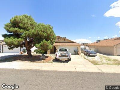
3902 Raymond Ave Kingman, AZ 86409
Estimated Value: $231,075 - $283,000
3
Beds
1
Bath
1,483
Sq Ft
$172/Sq Ft
Est. Value
About This Home
This home is located at 3902 Raymond Ave, Kingman, AZ 86409 and is currently estimated at $255,519, approximately $172 per square foot. 3902 Raymond Ave is a home located in Mohave County with nearby schools including Manzanita Elementary School, Kingman Middle School, and Kingman High School.
Ownership History
Date
Name
Owned For
Owner Type
Purchase Details
Closed on
Jan 31, 2025
Sold by
Hunter Nicholas
Bought by
Hunter Miles
Current Estimated Value
Purchase Details
Closed on
Aug 27, 2018
Sold by
Hunter Miles Jeffrey and Hunter Nicholas Andres
Bought by
Hunter Nicholas Andres
Purchase Details
Closed on
Jan 15, 2015
Sold by
Hunter Miles Jeffrey
Bought by
Hunter Nicholas Andres and Hunter Miles Jeffrey
Purchase Details
Closed on
Sep 14, 2007
Sold by
Hunter Miles
Bought by
Hunter Clara and Hunter Miles
Purchase Details
Closed on
Apr 21, 2005
Sold by
Hunter Clara Luz
Bought by
Hunter Miles
Home Financials for this Owner
Home Financials are based on the most recent Mortgage that was taken out on this home.
Original Mortgage
$140,000
Interest Rate
5.72%
Mortgage Type
Fannie Mae Freddie Mac
Create a Home Valuation Report for This Property
The Home Valuation Report is an in-depth analysis detailing your home's value as well as a comparison with similar homes in the area
Home Values in the Area
Average Home Value in this Area
Purchase History
| Date | Buyer | Sale Price | Title Company |
|---|---|---|---|
| Hunter Miles | -- | None Listed On Document | |
| Hunter Nicholas Andres | -- | None Available | |
| Hunter Nicholas Andres | -- | None Available | |
| Hunter Clara | -- | None Available | |
| Hunter Miles | -- | Transnation Title | |
| Hunter Miles | $175,000 | Transnation Title |
Source: Public Records
Mortgage History
| Date | Status | Borrower | Loan Amount |
|---|---|---|---|
| Previous Owner | Hunter Miles Jeffrey | $124,000 | |
| Previous Owner | Hunter Miles | $140,000 |
Source: Public Records
Tax History Compared to Growth
Tax History
| Year | Tax Paid | Tax Assessment Tax Assessment Total Assessment is a certain percentage of the fair market value that is determined by local assessors to be the total taxable value of land and additions on the property. | Land | Improvement |
|---|---|---|---|---|
| 2025 | $971 | $20,344 | $0 | $0 |
| 2024 | $971 | $22,589 | $0 | $0 |
| 2023 | $971 | $17,252 | $0 | $0 |
| 2022 | $901 | $14,225 | $0 | $0 |
| 2021 | $933 | $13,063 | $0 | $0 |
| 2019 | $852 | $11,123 | $0 | $0 |
| 2018 | $880 | $10,825 | $0 | $0 |
| 2017 | $809 | $10,468 | $0 | $0 |
| 2016 | $781 | $9,738 | $0 | $0 |
| 2015 | $797 | $8,649 | $0 | $0 |
Source: Public Records
Map
Nearby Homes
- 3855 Western Ave
- 1065 Palo Verde Dr
- 1055 Palo Verde Dr
- 1020 Hillcrest Dr
- 1045 Hillside Dr
- 3781 Henry Fonda Way
- 00 Stockton Hill Rd
- 0000 Stockton Hill Rd
- 3703 Stockton Hill Rd
- 324-26-394 Stockton Hill Rd
- 4818/4826 Stockton Hill Rd
- 007C Stockton Hill Rd
- Lots 3 Stockton Hill Rd
- 4007 Gordon Ln
- 988 Shadow Crest Way
- 000 Stockton Hill Rd
- 0 N Glen Rd
- 2013 Roy Rogers Way
- 988 Shadow Crest Cir
- 3725 Cantle Dr