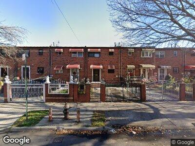
393 Wyona St Brooklyn, NY 11207
East New York NeighborhoodEstimated Value: $516,547 - $569,000
2
Beds
2
Baths
1,134
Sq Ft
$471/Sq Ft
Est. Value
About This Home
This home is located at 393 Wyona St, Brooklyn, NY 11207 and is currently estimated at $534,137, approximately $471 per square foot. 393 Wyona St is a home located in Kings County with nearby schools including P.S. 149 Danny Kaye, J.H.S 292 Margaret S. Douglas, and Hyde Leadership Charter School-Brooklyn.
Ownership History
Date
Name
Owned For
Owner Type
Purchase Details
Closed on
Feb 12, 2025
Sold by
Lewis Ricardo
Bought by
Aich Nadi
Current Estimated Value
Home Financials for this Owner
Home Financials are based on the most recent Mortgage that was taken out on this home.
Original Mortgage
$420,000
Outstanding Balance
$419,647
Interest Rate
6.87%
Mortgage Type
Purchase Money Mortgage
Estimated Equity
$111,591
Purchase Details
Closed on
Apr 8, 2024
Sold by
Last Will And Testament Of Patricia Dixon and Ricardo Lewis Executor
Bought by
Lewis Ricardo
Create a Home Valuation Report for This Property
The Home Valuation Report is an in-depth analysis detailing your home's value as well as a comparison with similar homes in the area
Home Values in the Area
Average Home Value in this Area
Purchase History
| Date | Buyer | Sale Price | Title Company |
|---|---|---|---|
| Aich Nadi | $525,000 | -- | |
| Lewis Ricardo | -- | -- | |
| Lewis Ricardo | -- | -- |
Source: Public Records
Mortgage History
| Date | Status | Borrower | Loan Amount |
|---|---|---|---|
| Open | Aich Nadi | $420,000 |
Source: Public Records
Tax History Compared to Growth
Tax History
| Year | Tax Paid | Tax Assessment Tax Assessment Total Assessment is a certain percentage of the fair market value that is determined by local assessors to be the total taxable value of land and additions on the property. | Land | Improvement |
|---|---|---|---|---|
| 2024 | $3,609 | $34,320 | $13,260 | $21,060 |
| 2023 | $3,443 | $34,320 | $13,260 | $21,060 |
| 2022 | $3,193 | $32,160 | $13,260 | $18,900 |
| 2021 | $3,327 | $24,840 | $13,260 | $11,580 |
| 2020 | $3,327 | $24,660 | $13,260 | $11,400 |
| 2019 | $3,132 | $24,660 | $13,260 | $11,400 |
| 2018 | $2,880 | $14,127 | $6,450 | $7,677 |
| 2017 | $2,717 | $13,328 | $7,918 | $5,410 |
| 2016 | $2,649 | $13,250 | $8,562 | $4,688 |
| 2015 | $1,403 | $13,226 | $9,013 | $4,213 |
| 2014 | $1,403 | $12,478 | $7,602 | $4,876 |
Source: Public Records
Map
Nearby Homes
- 412 Bradford St
- 380 Bradford St
- 440 Miller Ave
- 410 Vermont St
- 342 Wyona St
- 443 Miller Ave
- 667 Sutter Ave
- 414 Miller Ave
- 663 Sutter Ave
- 444 New Jersey Ave
- 470 Wyona St
- 353 Pennsylvania Ave
- 358 van Siclen Ave
- 385 van Siclen Ave
- 380 Miller Ave
- 297 Pennsylvania Ave
- 291 Granville Payne Ave
- 311 Sheffield Ave
- 816 Dumont Ave
- 502 Schenck Ave