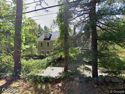
40 School St Dunstable, MA 01827
Estimated Value: $791,000 - $892,000
3
Beds
3
Baths
2,672
Sq Ft
$314/Sq Ft
Est. Value
About This Home
This home is located at 40 School St, Dunstable, MA 01827 and is currently estimated at $839,578, approximately $314 per square foot. 40 School St is a home located in Middlesex County with nearby schools including Groton Dunstable Regional High School.
Ownership History
Date
Name
Owned For
Owner Type
Purchase Details
Closed on
Oct 6, 2017
Sold by
Gail M Silveria Ret and Silveria Richard W
Bought by
Silveria Brittany G and Grove Robert S
Current Estimated Value
Home Financials for this Owner
Home Financials are based on the most recent Mortgage that was taken out on this home.
Original Mortgage
$350,000
Interest Rate
3.86%
Mortgage Type
New Conventional
Purchase Details
Closed on
May 7, 2014
Sold by
Silveria Richard W and Silveria Gail M
Bought by
Gail M Silveria Ret and Silveria Gail M
Purchase Details
Closed on
Apr 28, 1994
Sold by
Mcgovern George and Mcgovern Hugh
Bought by
Silveria Richard and Silveria Gail
Create a Home Valuation Report for This Property
The Home Valuation Report is an in-depth analysis detailing your home's value as well as a comparison with similar homes in the area
Home Values in the Area
Average Home Value in this Area
Purchase History
| Date | Buyer | Sale Price | Title Company |
|---|---|---|---|
| Silveria Brittany G | $440,000 | -- | |
| Gail M Silveria Ret | -- | -- | |
| Silveria Richard | $195,000 | -- |
Source: Public Records
Mortgage History
| Date | Status | Borrower | Loan Amount |
|---|---|---|---|
| Open | Grove Robert S | $224,000 | |
| Closed | Silveria Brittany G | $150,000 | |
| Closed | Silveria Brittany G | $350,000 | |
| Previous Owner | Silveria Richard | $50,000 | |
| Previous Owner | Silveria Richard | $279,000 | |
| Previous Owner | Silveria Richard | $39,300 |
Source: Public Records
Tax History Compared to Growth
Tax History
| Year | Tax Paid | Tax Assessment Tax Assessment Total Assessment is a certain percentage of the fair market value that is determined by local assessors to be the total taxable value of land and additions on the property. | Land | Improvement |
|---|---|---|---|---|
| 2024 | $9,646 | $691,000 | $202,700 | $488,300 |
| 2023 | $9,575 | $639,600 | $202,700 | $436,900 |
| 2022 | $8,866 | $581,400 | $202,700 | $378,700 |
| 2021 | $8,863 | $540,100 | $185,400 | $354,700 |
| 2020 | $8,718 | $517,700 | $177,200 | $340,500 |
| 2019 | $8,498 | $498,100 | $177,200 | $320,900 |
| 2018 | $8,374 | $477,400 | $176,200 | $301,200 |
| 2017 | $8,005 | $470,300 | $176,200 | $294,100 |
| 2016 | $7,792 | $470,800 | $176,200 | $294,600 |
| 2015 | $7,436 | $444,500 | $148,500 | $296,000 |
| 2014 | $7,010 | $444,500 | $148,500 | $296,000 |
Source: Public Records
Map
Nearby Homes
- 506 Old Dunstable Rd
- 4 Wilson Way
- 498 Old Dunstable Rd
- 0 Old Dunstable Rd
- 4 Patriot Rd
- 37 Jacques Rd
- 25 Jacques Rd
- 352 Nashua Rd
- 5 Olivia Way Unit 5
- 707 Martins Pond Rd
- 285 Westford Rd
- 12 Shawnee Rd
- 35 Red Gate Rd
- 38 Tarbell St Unit 1A
- 38 Tarbell St Unit 6B
- 38 Tarbell St Unit 8D
- 31 Fawn Terrace
- 573 Longley Rd
- 34 Tarbell St
- 473 High St