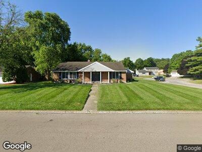
400 Burgess Ave Dayton, OH 45415
Shiloh NeighborhoodEstimated Value: $149,000 - $232,000
3
Beds
3
Baths
2,235
Sq Ft
$94/Sq Ft
Est. Value
About This Home
This home is located at 400 Burgess Ave, Dayton, OH 45415 and is currently estimated at $210,708, approximately $94 per square foot. 400 Burgess Ave is a home located in Montgomery County with nearby schools including Valerie Elementary School, Imagine Schools - Woodbury Academy, and Horizon Science Academy-Dayton Elementary School.
Ownership History
Date
Name
Owned For
Owner Type
Purchase Details
Closed on
Jan 19, 2017
Sold by
Secretary Of Veterans Affairs
Bought by
Douglas Zarion M
Current Estimated Value
Home Financials for this Owner
Home Financials are based on the most recent Mortgage that was taken out on this home.
Original Mortgage
$69,840
Outstanding Balance
$58,451
Interest Rate
4.16%
Mortgage Type
Purchase Money Mortgage
Estimated Equity
$152,257
Purchase Details
Closed on
Aug 15, 2016
Sold by
Hogans Michael and Hogans Tresia L
Bought by
Secretary Of Veterans Affairs
Purchase Details
Closed on
Feb 25, 2005
Sold by
Ritter Elfrieda
Bought by
Hogans Michael and Hogans Tresia L
Home Financials for this Owner
Home Financials are based on the most recent Mortgage that was taken out on this home.
Original Mortgage
$125,133
Interest Rate
5.71%
Mortgage Type
VA
Create a Home Valuation Report for This Property
The Home Valuation Report is an in-depth analysis detailing your home's value as well as a comparison with similar homes in the area
Home Values in the Area
Average Home Value in this Area
Purchase History
| Date | Buyer | Sale Price | Title Company |
|---|---|---|---|
| Douglas Zarion M | -- | First Ohio Title Insurance | |
| Secretary Of Veterans Affairs | $56,000 | None Available | |
| Hogans Michael | $122,500 | Midwest Abstract Company |
Source: Public Records
Mortgage History
| Date | Status | Borrower | Loan Amount |
|---|---|---|---|
| Open | Douglas Zarion M | $69,840 | |
| Previous Owner | Hogans Michael | $102,957 | |
| Previous Owner | Hogans Michael | $125,133 |
Source: Public Records
Tax History Compared to Growth
Tax History
| Year | Tax Paid | Tax Assessment Tax Assessment Total Assessment is a certain percentage of the fair market value that is determined by local assessors to be the total taxable value of land and additions on the property. | Land | Improvement |
|---|---|---|---|---|
| 2024 | $4,567 | $62,920 | $14,350 | $48,570 |
| 2023 | $4,567 | $62,920 | $14,350 | $48,570 |
| 2022 | $3,796 | $38,370 | $8,750 | $29,620 |
| 2021 | $3,782 | $38,370 | $8,750 | $29,620 |
| 2020 | $3,805 | $38,370 | $8,750 | $29,620 |
| 2019 | $3,315 | $29,630 | $8,190 | $21,440 |
| 2018 | $3,258 | $29,630 | $8,190 | $21,440 |
| 2017 | $3,239 | $29,630 | $8,190 | $21,440 |
| 2016 | $3,547 | $29,530 | $9,100 | $20,430 |
| 2015 | $2,978 | $29,530 | $9,100 | $20,430 |
| 2014 | $2,978 | $29,530 | $9,100 | $20,430 |
| 2012 | -- | $35,510 | $9,100 | $26,410 |
Source: Public Records
Map
Nearby Homes
- 5641 Jeannie Ct
- 5527 Rose Terrace
- 341 Bon Air Dr
- 100 Minty Dr
- 130 Burgess Ave
- 159 Burgess Ave
- 5320 Susan Dr
- 5924 N Main St
- 5530 Beejay Ct
- 5452 Cornwall Dr
- 127 W Woodbury Dr
- 243 Briarcliff Rd
- 6909 N Main St
- 8090 Dog Leg Rd
- 5462 Fairford Ct
- 6475 Landsend Ct
- 6552 Stillcrest Way
- 4807 Shiloh View Dr
- 6100 Brantford Rd
- 201 Winding Ridge Dr