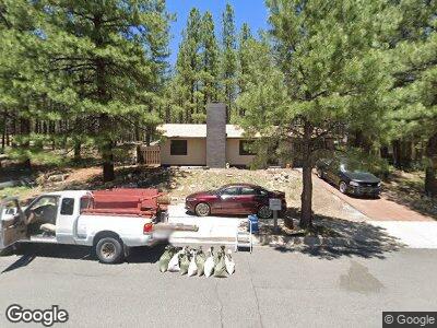
400 E Bennett Dr Flagstaff, AZ 86001
Bennett Estates NeighborhoodEstimated Value: $444,315 - $542,000
--
Bed
--
Bath
864
Sq Ft
$561/Sq Ft
Est. Value
About This Home
This home is located at 400 E Bennett Dr, Flagstaff, AZ 86001 and is currently estimated at $484,579, approximately $560 per square foot. 400 E Bennett Dr is a home located in Coconino County with nearby schools including Lura Kinsey Elementary School, Flagstaff High School, and Mountain School.
Ownership History
Date
Name
Owned For
Owner Type
Purchase Details
Closed on
Mar 19, 2021
Sold by
Baker Sally B and Baker Jacob M
Bought by
Wakeford Betty Jean and Betty Jean Wakeford Trust
Current Estimated Value
Purchase Details
Closed on
Jan 15, 2021
Sold by
Baker Jacob Marion
Bought by
Baker Sally B
Purchase Details
Closed on
Jan 9, 2013
Sold by
Laughman Rebecca June and Baker Jacob M
Bought by
Baker Jacob M and Baker Sally
Purchase Details
Closed on
Nov 20, 2012
Sold by
Estate Of Rebecca June Laughman and Barker Jacob M
Bought by
Baker Jacob M and Baker Sally
Create a Home Valuation Report for This Property
The Home Valuation Report is an in-depth analysis detailing your home's value as well as a comparison with similar homes in the area
Home Values in the Area
Average Home Value in this Area
Purchase History
| Date | Buyer | Sale Price | Title Company |
|---|---|---|---|
| Wakeford Betty Jean | -- | None Available | |
| Baker Jacob M | -- | None Available |
Source: Public Records
Mortgage History
| Date | Status | Borrower | Loan Amount |
|---|---|---|---|
| Previous Owner | Laughman Rebecca J | $35,835 | |
| Previous Owner | Laughman Rebecca J | $37,000 |
Source: Public Records
Tax History Compared to Growth
Tax History
| Year | Tax Paid | Tax Assessment Tax Assessment Total Assessment is a certain percentage of the fair market value that is determined by local assessors to be the total taxable value of land and additions on the property. | Land | Improvement |
|---|---|---|---|---|
| 2024 | $1,918 | $38,561 | -- | -- |
| 2023 | $1,844 | $29,981 | $0 | $0 |
| 2022 | $1,731 | $24,266 | $0 | $0 |
| 2021 | $1,683 | $23,843 | $0 | $0 |
| 2020 | $1,636 | $22,852 | $0 | $0 |
| 2019 | $1,605 | $21,147 | $0 | $0 |
| 2018 | $1,561 | $20,234 | $0 | $0 |
| 2017 | $1,469 | $19,499 | $0 | $0 |
| 2016 | $1,461 | $16,947 | $0 | $0 |
| 2015 | $1,100 | $15,014 | $0 | $0 |
Source: Public Records
Map
Nearby Homes
- 473 E Clover Creek Dr
- 522 E Twelve Oaks Dr
- 4088 S Kendall St
- 23 E Judy St
- 5212 S Opal Rd
- 4060 S Wild Trail W
- 80 W Hance Trail
- 100 W Agate Ct
- 4946 S Topaz Rd Unit 61
- 3811 S Sutter Creek Trail
- 1304 W Lil Ben Trail
- 5053 S Topaz Rd
- 575 W Cattle Drive Trail Unit 3A3C
- 3800 S Wagon Trail
- 630 W Cattle Drive Trail
- 310 W Wulfenite Rd
- 5093 S Amethyst Rd
- 3244 S Gila Dr
- 417 W Wulfenite Rd
- 97 E Tranquil Ln