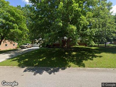
400 Eastdale Dr Dayton, OH 45415
Shiloh NeighborhoodEstimated Value: $165,295 - $235,000
3
Beds
2
Baths
1,557
Sq Ft
$129/Sq Ft
Est. Value
About This Home
This home is located at 400 Eastdale Dr, Dayton, OH 45415 and is currently estimated at $200,824, approximately $128 per square foot. 400 Eastdale Dr is a home located in Montgomery County with nearby schools including Valerie Elementary School, Imagine Schools - Woodbury Academy, and Horizon Science Academy-Dayton Elementary School.
Ownership History
Date
Name
Owned For
Owner Type
Purchase Details
Closed on
Nov 10, 2021
Sold by
Mergler James F and Mergler Lorraine B
Bought by
Townview Investment Properties Llc
Current Estimated Value
Purchase Details
Closed on
Dec 26, 2001
Sold by
Gradsky Lorraine B and Gradsky Lorraine B
Bought by
Mergler James F and Mergler Lorraine B
Home Financials for this Owner
Home Financials are based on the most recent Mortgage that was taken out on this home.
Original Mortgage
$106,500
Interest Rate
7.07%
Create a Home Valuation Report for This Property
The Home Valuation Report is an in-depth analysis detailing your home's value as well as a comparison with similar homes in the area
Home Values in the Area
Average Home Value in this Area
Purchase History
| Date | Buyer | Sale Price | Title Company |
|---|---|---|---|
| Townview Investment Properties Llc | $79,000 | Pctitle Pros | |
| Mergler James F | -- | Republic Title Agency Inc |
Source: Public Records
Mortgage History
| Date | Status | Borrower | Loan Amount |
|---|---|---|---|
| Previous Owner | Mergler James F | $106,500 | |
| Previous Owner | Mergler James F | $21,000 |
Source: Public Records
Tax History Compared to Growth
Tax History
| Year | Tax Paid | Tax Assessment Tax Assessment Total Assessment is a certain percentage of the fair market value that is determined by local assessors to be the total taxable value of land and additions on the property. | Land | Improvement |
|---|---|---|---|---|
| 2024 | $4,526 | $61,200 | $17,650 | $43,550 |
| 2023 | $4,526 | $61,200 | $17,650 | $43,550 |
| 2022 | $3,798 | $37,320 | $10,770 | $26,550 |
| 2021 | $3,944 | $37,320 | $10,770 | $26,550 |
| 2020 | $3,814 | $37,320 | $10,770 | $26,550 |
| 2019 | $3,899 | $33,840 | $9,690 | $24,150 |
| 2018 | $3,857 | $33,840 | $9,690 | $24,150 |
| 2017 | $3,670 | $33,840 | $9,690 | $24,150 |
| 2016 | $3,783 | $33,340 | $10,770 | $22,570 |
| 2015 | $3,265 | $33,340 | $10,770 | $22,570 |
| 2014 | $3,265 | $33,340 | $10,770 | $22,570 |
| 2012 | -- | $36,540 | $10,710 | $25,830 |
Source: Public Records
Map
Nearby Homes
- 130 Burgess Ave
- 159 Burgess Ave
- 5641 Jeannie Ct
- 5527 Rose Terrace
- 5452 Cornwall Dr
- 5924 N Main St
- 341 Bon Air Dr
- 100 Minty Dr
- 127 W Woodbury Dr
- 6909 N Main St
- 201 Winding Ridge Dr
- 4807 Shiloh View Dr
- 7400 N Main St
- 5320 Susan Dr
- 5331 Birchbend Ct
- 4551 Lansmore Dr Unit B
- 4623 Merrick Dr Unit B
- 243 Briarcliff Rd
- 4531 Lansmore Dr Unit 95
- 4601 Merrick Dr Unit 79
