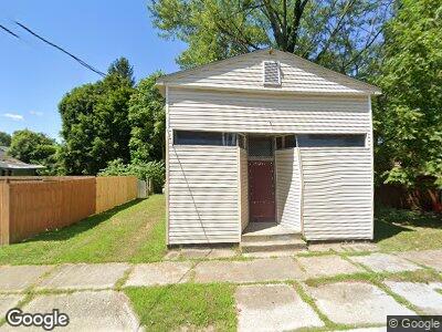
4020 Erie St Youngstown, OH 44512
Estimated Value: $31,057
3
Beds
2
Baths
588
Sq Ft
$53/Sq Ft
Est. Value
About This Home
This home is located at 4020 Erie St, Youngstown, OH 44512 and is currently estimated at $31,057, approximately $52 per square foot. 4020 Erie St is a home located in Mahoning County with nearby schools including Taft Elementary School, East High School, and Horizon Science Academy - Youngstown.
Ownership History
Date
Name
Owned For
Owner Type
Purchase Details
Closed on
Feb 6, 2024
Sold by
Kendail Tremaine Banks Trust and Banks Kendail Tremaine
Bought by
Eye Evolve Foundation Llc
Current Estimated Value
Purchase Details
Closed on
Aug 17, 2022
Bought by
Banks Kendail Tremaine
Purchase Details
Closed on
Aug 5, 2022
Sold by
Italiano Electrical Construction Llc
Bought by
Kendail Tremaine Banks Trust and Banks
Purchase Details
Closed on
Jun 9, 2017
Sold by
Prime Properties Management Group Llc
Bought by
Italiano Electrical Construction Llc
Purchase Details
Closed on
Jun 28, 2008
Sold by
Joseph Ron and Joseph Margaret A
Bought by
Prime Properties Management Group Llc
Purchase Details
Closed on
Jun 1, 1984
Bought by
Joseph Ron
Create a Home Valuation Report for This Property
The Home Valuation Report is an in-depth analysis detailing your home's value as well as a comparison with similar homes in the area
Home Values in the Area
Average Home Value in this Area
Purchase History
| Date | Buyer | Sale Price | Title Company |
|---|---|---|---|
| Eye Evolve Foundation Llc | -- | None Listed On Document | |
| Banks Kendail Tremaine | $27,500 | -- | |
| Kendail Tremaine Banks Trust | $27,500 | None Listed On Document | |
| Italiano Electrical Construction Llc | $1,000 | None Available | |
| Prime Properties Management Group Llc | -- | Safeguard Title Agency | |
| Joseph Ron | $16,000 | -- |
Source: Public Records
Tax History Compared to Growth
Tax History
| Year | Tax Paid | Tax Assessment Tax Assessment Total Assessment is a certain percentage of the fair market value that is determined by local assessors to be the total taxable value of land and additions on the property. | Land | Improvement |
|---|---|---|---|---|
| 2024 | $587 | $8,140 | $1,070 | $7,070 |
| 2023 | $588 | $8,140 | $1,070 | $7,070 |
| 2022 | $156 | $1,910 | $1,070 | $840 |
| 2021 | $156 | $1,910 | $1,070 | $840 |
| 2020 | $157 | $1,910 | $1,070 | $840 |
| 2019 | $163 | $1,910 | $1,070 | $840 |
| 2018 | $173 | $1,910 | $1,070 | $840 |
| 2017 | $163 | $1,910 | $1,070 | $840 |
| 2016 | $165 | $1,990 | $1,070 | $920 |
| 2015 | $161 | $1,990 | $1,070 | $920 |
| 2014 | $160 | $1,990 | $1,070 | $920 |
| 2013 | $157 | $1,990 | $1,070 | $920 |
Source: Public Records
Map
Nearby Homes
- 210 Hollywood Ave
- 168 Lowell Ave
- 196 Maywood Dr
- 4206 Rush Blvd
- 181 E Judson Ave
- 3938 Helena Ave
- 4432 Erie St
- 324 Hilton Ave
- 330 Hilton Ave
- 34 Labelle Ave
- 184 Shadyside Dr
- 136 E Auburndale Ave
- 358 E Auburndale Ave
- 3601 Beechwood Place
- 155 Beechwood Dr
- 703 E Judson Ave
- 579 Roxbury Ave
- 138 Clifton Dr
- 4245 Chester Dr
- 4804 Grover Dr