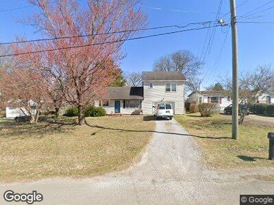
404 Marwood Ct Nashville, TN 37210
Donelson NeighborhoodEstimated Value: $247,000 - $415,926
3
Beds
2
Baths
1,584
Sq Ft
$211/Sq Ft
Est. Value
About This Home
This home is located at 404 Marwood Ct, Nashville, TN 37210 and is currently estimated at $334,482, approximately $211 per square foot. 404 Marwood Ct is a home located in Davidson County with nearby schools including McGavock Elementary School, Two Rivers Middle School, and McGavock High School.
Ownership History
Date
Name
Owned For
Owner Type
Purchase Details
Closed on
Apr 26, 2000
Sold by
Bilbrey Shelley L
Bought by
Rice Harold
Current Estimated Value
Home Financials for this Owner
Home Financials are based on the most recent Mortgage that was taken out on this home.
Original Mortgage
$79,959
Interest Rate
8.24%
Mortgage Type
FHA
Purchase Details
Closed on
Sep 25, 1996
Sold by
Green Terry D
Bought by
Bilbrey Shelley L
Create a Home Valuation Report for This Property
The Home Valuation Report is an in-depth analysis detailing your home's value as well as a comparison with similar homes in the area
Home Values in the Area
Average Home Value in this Area
Purchase History
| Date | Buyer | Sale Price | Title Company |
|---|---|---|---|
| Rice Harold | $80,000 | Castleman Title & Escrow Inc | |
| Bilbrey Shelley L | $67,000 | -- |
Source: Public Records
Mortgage History
| Date | Status | Borrower | Loan Amount |
|---|---|---|---|
| Open | Rice Harold | $23,000 | |
| Closed | Rice Harold | $32,000 | |
| Closed | Rice Harold | $72,400 | |
| Closed | Rice Harold | $10,000 | |
| Closed | Rice Harold | $79,959 |
Source: Public Records
Tax History Compared to Growth
Tax History
| Year | Tax Paid | Tax Assessment Tax Assessment Total Assessment is a certain percentage of the fair market value that is determined by local assessors to be the total taxable value of land and additions on the property. | Land | Improvement |
|---|---|---|---|---|
| 2024 | $2,209 | $67,875 | $10,000 | $57,875 |
| 2023 | $2,209 | $67,875 | $10,000 | $57,875 |
| 2022 | $2,571 | $67,875 | $10,000 | $57,875 |
| 2021 | $2,232 | $67,875 | $10,000 | $57,875 |
| 2020 | $1,839 | $43,575 | $5,400 | $38,175 |
| 2019 | $1,375 | $43,575 | $5,400 | $38,175 |
| 2018 | $0 | $43,575 | $5,400 | $38,175 |
| 2017 | $0 | $43,575 | $5,400 | $38,175 |
| 2016 | $1,333 | $29,525 | $5,500 | $24,025 |
| 2015 | $1,333 | $29,525 | $5,500 | $24,025 |
| 2014 | $1,333 | $29,525 | $5,500 | $24,025 |
Source: Public Records
Map
Nearby Homes
- 312 Spence Cir
- 202 Spence Ln Unit 103
- 1526 Lebanon Pike
- 1540 Lebanon Pike Unit 311
- 0 Ivywood Dr Unit RTC2801563
- 269 Clovernook Dr
- 1917 Dabbs Ave
- 1923 Dabbs Ave
- 214 Gayland Ct
- 1905 Laurinda Dr
- 208 Oak Grove Dr Unit 208
- 217 Oak Grove Dr Unit 217
- 803 Elissa Dr
- 1041 Harold Dr Unit B1041
- 1045 Harold Dr
- 820 Patricia Dr
- 1961 Dabbs Ave
- 1100 Massman Dr
- 1916 Louanne Dr
- 916 Radford Dr