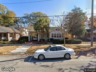
406 Woodrow St Columbia, SC 29205
Rosewood NeighborhoodEstimated Value: $470,000 - $590,493
3
Beds
2
Baths
1,913
Sq Ft
$278/Sq Ft
Est. Value
About This Home
This home is located at 406 Woodrow St, Columbia, SC 29205 and is currently estimated at $532,623, approximately $278 per square foot. 406 Woodrow St is a home located in Richland County with nearby schools including A. C. Moore Elementary School, Hand Middle School, and Dreher High School.
Ownership History
Date
Name
Owned For
Owner Type
Purchase Details
Closed on
Jul 7, 2022
Sold by
Leventis Athena J
Bought by
Boyer Ann L
Current Estimated Value
Purchase Details
Closed on
May 24, 2001
Sold by
Wilson George Jacob and Wilson Christina B
Bought by
Leventis Athena J
Home Financials for this Owner
Home Financials are based on the most recent Mortgage that was taken out on this home.
Original Mortgage
$40,000
Interest Rate
7.09%
Mortgage Type
Credit Line Revolving
Create a Home Valuation Report for This Property
The Home Valuation Report is an in-depth analysis detailing your home's value as well as a comparison with similar homes in the area
Home Values in the Area
Average Home Value in this Area
Purchase History
| Date | Buyer | Sale Price | Title Company |
|---|---|---|---|
| Leventis Athena J | $212,300 | -- |
Source: Public Records
Mortgage History
| Date | Status | Borrower | Loan Amount |
|---|---|---|---|
| Closed | Leventis Athena J | $173,000 | |
| Closed | Leventis Athena J | $173,000 | |
| Closed | Leventis Athena J | $40,000 | |
| Closed | Leventis Athena J | $177,003 | |
| Closed | Leventis Athena J | $40,000 | |
| Closed | Leventis Athena J | $169,840 | |
| Previous Owner | Wilson George Jacob | $34,000 | |
| Previous Owner | Wilson George Jacob | $25,000 |
Source: Public Records
Tax History Compared to Growth
Tax History
| Year | Tax Paid | Tax Assessment Tax Assessment Total Assessment is a certain percentage of the fair market value that is determined by local assessors to be the total taxable value of land and additions on the property. | Land | Improvement |
|---|---|---|---|---|
| 2023 | $2,880 | $10,920 | $0 | $0 |
| 2022 | $1,980 | $273,000 | $87,400 | $185,600 |
| 2021 | $2,045 | $10,920 | $0 | $0 |
| 2020 | $2,157 | $10,920 | $0 | $0 |
| 2019 | $2,172 | $10,920 | $0 | $0 |
| 2018 | $1,933 | $9,500 | $0 | $0 |
| 2017 | $1,883 | $9,500 | $0 | $0 |
| 2016 | $1,816 | $9,500 | $0 | $0 |
| 2015 | $1,816 | $9,500 | $0 | $0 |
| 2014 | $1,814 | $237,400 | $0 | $0 |
| 2013 | -- | $9,500 | $0 | $0 |
Source: Public Records
Map
Nearby Homes
- 409 Maple St
- 2737 Blossom St
- 2812 Duncan St
- 619 King St Unit 209
- 2502 Wheat St
- 2737 Burney Dr
- 705 Maple St Unit G-103
- 705 Maple St Unit 203
- 2512 Heyward St
- 2614 Burney Dr
- 2538 Lee St
- 2412 Monroe St
- 522 Sims Ave
- 215 S Holly St
- 111 Harden St
- 101 Harden St
- 2709 Preston St
- 3001 Kirkwood Rd
- 126 S Sims Ave
- 3215 Blossom St