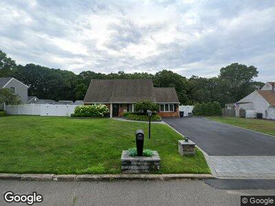
41 Susan Dr Bellport, NY 11713
North Bellport NeighborhoodEstimated Value: $798,567
4
Beds
1
Bath
1,584
Sq Ft
$504/Sq Ft
Est. Value
About This Home
This home is located at 41 Susan Dr, Bellport, NY 11713 and is currently estimated at $798,567, approximately $504 per square foot. 41 Susan Dr is a home located in Suffolk County with nearby schools including Frank P Long Intermediate School, Bellport Middle School, and Bellport Senior High School.
Ownership History
Date
Name
Owned For
Owner Type
Purchase Details
Closed on
Nov 8, 2023
Sold by
Rieb Thomas Scott Est and Reib
Bought by
Rieb Jeanna M and Rieb Samantha
Current Estimated Value
Purchase Details
Closed on
Apr 14, 2000
Sold by
Scarborough Sharon V
Bought by
Rieb Thomas
Home Financials for this Owner
Home Financials are based on the most recent Mortgage that was taken out on this home.
Original Mortgage
$124,450
Interest Rate
8.1%
Mortgage Type
Purchase Money Mortgage
Create a Home Valuation Report for This Property
The Home Valuation Report is an in-depth analysis detailing your home's value as well as a comparison with similar homes in the area
Home Values in the Area
Average Home Value in this Area
Purchase History
| Date | Buyer | Sale Price | Title Company |
|---|---|---|---|
| Rieb Jeanna M | $50,000 | Misc Company | |
| Rieb Jeanna M | $50,000 | Misc Company | |
| Rieb Thomas | $131,000 | Title & Abstract | |
| Rieb Thomas | $131,000 | Title & Abstract |
Source: Public Records
Mortgage History
| Date | Status | Borrower | Loan Amount |
|---|---|---|---|
| Previous Owner | Rieb Thomas | $124,450 |
Source: Public Records
Tax History Compared to Growth
Tax History
| Year | Tax Paid | Tax Assessment Tax Assessment Total Assessment is a certain percentage of the fair market value that is determined by local assessors to be the total taxable value of land and additions on the property. | Land | Improvement |
|---|---|---|---|---|
| 2023 | $9,122 | $2,550 | $300 | $2,250 |
| 2022 | $8,079 | $2,550 | $300 | $2,250 |
| 2021 | $8,079 | $2,550 | $300 | $2,250 |
| 2020 | $8,432 | $2,550 | $300 | $2,250 |
| 2019 | $8,432 | $0 | $0 | $0 |
| 2018 | $7,864 | $2,550 | $300 | $2,250 |
| 2017 | $7,864 | $2,550 | $300 | $2,250 |
| 2016 | $7,849 | $2,550 | $300 | $2,250 |
| 2015 | -- | $2,550 | $300 | $2,250 |
| 2014 | -- | $2,550 | $300 | $2,250 |
Source: Public Records
Map
Nearby Homes
- 0 Association Rd Unit ONE3578805
- 40 Maple Ave
- 17 Susan Dr
- 427 Macdonald Ave
- 0 Weaver Ave
- 333 Atlantic Ave
- 533 Bourdois Ave
- 71 Colonial Ln
- 0 Davidson Ave
- 91 Circuit Rd
- 103 N Howells Point Rd
- 98 Bieselin Rd
- 89 Circuit Rd
- 641 (2122) Bourdois Ave
- Lot (2135) Macdonald Ave
- 624 Bayview Ave
- 62 Beaver Dam Rd
- 640 Hoffman Ave
- 643 Doane Ave
- 522 Scherger Ave