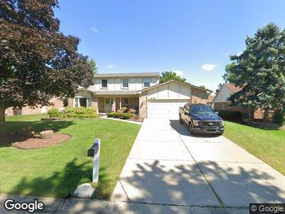
41198 Stone Haven Rd Northville, MI 48168
Northville Township NeighborhoodEstimated Value: $499,000 - $586,000
4
Beds
3
Baths
2,268
Sq Ft
$239/Sq Ft
Est. Value
About This Home
This home is located at 41198 Stone Haven Rd, Northville, MI 48168 and is currently estimated at $542,753, approximately $239 per square foot. 41198 Stone Haven Rd is a home located in Wayne County with nearby schools including Winchester Elementary School, Meads Mill Middle School, and Northville High School.
Ownership History
Date
Name
Owned For
Owner Type
Purchase Details
Closed on
Jun 8, 2011
Sold by
Peng John H and Peng Eunice
Bought by
Lawson Eric W and Lawson Laura A
Current Estimated Value
Home Financials for this Owner
Home Financials are based on the most recent Mortgage that was taken out on this home.
Original Mortgage
$194,400
Interest Rate
4.67%
Mortgage Type
New Conventional
Purchase Details
Closed on
Aug 30, 2005
Sold by
Heath Michael B and Heath Sharon E
Bought by
Peng John H
Home Financials for this Owner
Home Financials are based on the most recent Mortgage that was taken out on this home.
Original Mortgage
$274,400
Interest Rate
5.89%
Mortgage Type
Fannie Mae Freddie Mac
Create a Home Valuation Report for This Property
The Home Valuation Report is an in-depth analysis detailing your home's value as well as a comparison with similar homes in the area
Home Values in the Area
Average Home Value in this Area
Purchase History
| Date | Buyer | Sale Price | Title Company |
|---|---|---|---|
| Lawson Eric W | $244,900 | Embassy Title Agency Inc | |
| Peng John H | $343,000 | Pioneer Title Services |
Source: Public Records
Mortgage History
| Date | Status | Borrower | Loan Amount |
|---|---|---|---|
| Open | Lawson Eric W | $192,000 | |
| Closed | Lawson Eric W | $192,900 | |
| Closed | Lawson Eric W | $194,400 | |
| Previous Owner | Peng John H | $274,400 | |
| Previous Owner | Peng John H | $34,300 | |
| Previous Owner | Heath Michael B | $100,000 |
Source: Public Records
Tax History Compared to Growth
Tax History
| Year | Tax Paid | Tax Assessment Tax Assessment Total Assessment is a certain percentage of the fair market value that is determined by local assessors to be the total taxable value of land and additions on the property. | Land | Improvement |
|---|---|---|---|---|
| 2024 | $3,373 | $230,500 | $0 | $0 |
| 2023 | $3,218 | $209,200 | $0 | $0 |
| 2022 | $5,097 | $184,200 | $0 | $0 |
| 2021 | $5,017 | $181,400 | $0 | $0 |
| 2020 | $5,007 | $176,400 | $0 | $0 |
| 2019 | $4,915 | $172,900 | $0 | $0 |
| 2018 | $2,793 | $167,800 | $0 | $0 |
| 2017 | $3,819 | $164,700 | $0 | $0 |
| 2016 | $4,564 | $165,700 | $0 | $0 |
| 2015 | $12,635 | $147,700 | $0 | $0 |
| 2013 | $12,240 | $128,300 | $0 | $0 |
| 2012 | $6,390 | $125,200 | $16,900 | $108,300 |
Source: Public Records
Map
Nearby Homes
- 41250 Appleby Ct
- 16161 Weatherfield Dr
- 16264 White Haven Dr
- 39715 Dun Rovin Dr Unit 33
- 39793 Eagle Trace Dr
- 15563 Marilyn Ave
- 251 N Sydney Ct
- 16552 Country Knoll Dr
- 39627 Dun Rovin Dr
- 39576 Village Run Dr
- 39554 Village Run Dr
- 39612 Greenbrier Ct
- 39559 Muirfield Ln
- 15238 Farmbrook Dr
- 40764 Crabtree Ln
- 41415 Five Mile Rd
- 39547 Champion Ct
- 17018 White Haven Dr
- 17108 Maple Hill Dr
- 15194 Amber Ct