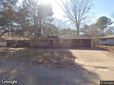
412 Springfield Cir Jackson, MS 39209
West Jackson NeighborhoodEstimated Value: $62,000 - $77,000
3
Beds
2
Baths
1,354
Sq Ft
$52/Sq Ft
Est. Value
About This Home
This home is located at 412 Springfield Cir, Jackson, MS 39209 and is currently estimated at $69,745, approximately $51 per square foot. 412 Springfield Cir is a home located in Hinds County with nearby schools including Hardy Middle School, Provine High School, and Ambition Preparatory Charter School.
Ownership History
Date
Name
Owned For
Owner Type
Purchase Details
Closed on
Nov 10, 2020
Sold by
Brister Robert
Bought by
Amc Development Llc
Current Estimated Value
Home Financials for this Owner
Home Financials are based on the most recent Mortgage that was taken out on this home.
Original Mortgage
$37,000
Interest Rate
2.8%
Mortgage Type
Land Contract Argmt. Of Sale
Purchase Details
Closed on
May 5, 2011
Sold by
Llp Mortgage Ltd
Bought by
Brister Robert
Create a Home Valuation Report for This Property
The Home Valuation Report is an in-depth analysis detailing your home's value as well as a comparison with similar homes in the area
Home Values in the Area
Average Home Value in this Area
Purchase History
| Date | Buyer | Sale Price | Title Company |
|---|---|---|---|
| Amc Development Llc | -- | None Available | |
| Brister Robert | -- | -- |
Source: Public Records
Mortgage History
| Date | Status | Borrower | Loan Amount |
|---|---|---|---|
| Closed | Amc Development Llc | $37,000 |
Source: Public Records
Tax History Compared to Growth
Tax History
| Year | Tax Paid | Tax Assessment Tax Assessment Total Assessment is a certain percentage of the fair market value that is determined by local assessors to be the total taxable value of land and additions on the property. | Land | Improvement |
|---|---|---|---|---|
| 2024 | $1,363 | $7,053 | $1,650 | $5,403 |
| 2023 | $1,363 | $7,053 | $1,650 | $5,403 |
| 2022 | $1,357 | $7,053 | $1,650 | $5,403 |
| 2021 | $1,357 | $7,053 | $1,650 | $5,403 |
| 2020 | $1,340 | $7,004 | $1,650 | $5,354 |
| 2019 | $1,341 | $7,004 | $1,650 | $5,354 |
| 2018 | $1,326 | $7,004 | $1,650 | $5,354 |
| 2017 | $1,317 | $7,004 | $1,650 | $5,354 |
| 2016 | $1,317 | $7,140 | $1,650 | $5,490 |
| 2015 | $1,256 | $7,014 | $1,650 | $5,364 |
| 2014 | $1,254 | $7,014 | $1,650 | $5,364 |
Source: Public Records
Map
Nearby Homes
- 253 Rowland Ave
- 103 Fair Ct
- 4434 Joel Ave
- 196 Dixon Rd
- 624 W Hillsdale Dr
- 0 Highway 80 Hwy Unit 1196194
- 425 Windsor Dr
- 214 Merrimack St
- 212 Gaylyn Dr
- 0 Hoover St
- 128 Carolyn Ave
- 5226 Andover Dr
- 4570 Ritchey Dr
- 4228 Johnson Ct
- 308 N Flag Chapel Rd
- 355 Ford Ave
- 362 Ford Ave
- 162 Ford Ave
- 504 Road of Remembrance
- 0 Sewanee Dr