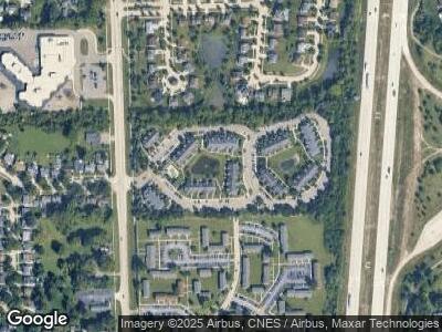
41265 Crossbow Cir Canton, MI 48188
Canton Township Neighborhood
--
Bed
--
Bath
--
Sq Ft
12
Acres
About This Home
This home is located at 41265 Crossbow Cir, Canton, MI 48188. 41265 Crossbow Cir is a home located in Wayne County with nearby schools including Canton High School, Salem High School, and Plymouth High School.
Ownership History
Date
Name
Owned For
Owner Type
Purchase Details
Closed on
Aug 12, 2016
Sold by
Canton Club East Partners Limited Divide
Bought by
Cce Acquisition Llc
Home Financials for this Owner
Home Financials are based on the most recent Mortgage that was taken out on this home.
Original Mortgage
$12,968,000
Interest Rate
3.45%
Mortgage Type
Future Advance Clause Open End Mortgage
Purchase Details
Closed on
Jul 1, 2005
Sold by
Demblewski Heather L and Cook Heather
Bought by
Cook Gary S
Create a Home Valuation Report for This Property
The Home Valuation Report is an in-depth analysis detailing your home's value as well as a comparison with similar homes in the area
Home Values in the Area
Average Home Value in this Area
Purchase History
| Date | Buyer | Sale Price | Title Company |
|---|---|---|---|
| Cce Acquisition Llc | -- | First American Title Ins Co | |
| Cook Gary S | $3,000 | First American Title |
Source: Public Records
Mortgage History
| Date | Status | Borrower | Loan Amount |
|---|---|---|---|
| Open | Cce Acquisition Llc | $20,500,000 | |
| Closed | Cce Acquisition Llc | $3,585,000 | |
| Closed | Cce Acquisition Llc | $12,968,000 |
Source: Public Records
Tax History Compared to Growth
Tax History
| Year | Tax Paid | Tax Assessment Tax Assessment Total Assessment is a certain percentage of the fair market value that is determined by local assessors to be the total taxable value of land and additions on the property. | Land | Improvement |
|---|---|---|---|---|
| 2024 | $178,273 | $7,498,500 | $0 | $0 |
| 2023 | $169,871 | $7,498,500 | $0 | $0 |
| 2022 | $259,831 | $7,498,500 | $0 | $0 |
| 2021 | $257,398 | $6,310,800 | $0 | $0 |
| 2020 | $249,147 | $6,310,800 | $0 | $0 |
| 2019 | $244,517 | $6,310,760 | $0 | $0 |
| 2018 | $146,204 | $4,558,020 | $0 | $0 |
| 2017 | $141,611 | $4,000,600 | $0 | $0 |
| 2016 | $198,487 | $4,000,600 | $0 | $0 |
| 2015 | $338,250 | $3,539,850 | $0 | $0 |
| 2013 | $352,728 | $3,667,180 | $0 | $0 |
| 2010 | -- | $4,161,220 | $2,171,031 | $1,990,189 |
Source: Public Records
Map
Nearby Homes
- 41421 Ayrshire Dr
- 41223 Southwind Dr
- 41358 Southwind Dr
- 40882 Bluesprings Ct
- 41160 Northwind Dr Unit 36
- 41788 Princess Dr
- 1695 Woodstock St
- 42340 Old Bridge Rd
- 185 Sheffield Ct Unit 1
- 2105 Arcadia Dr Unit 62
- 41537 Wild Turkey Ln Unit 98
- 800 Georgetown St
- 41631 Wild Turkey Ln
- 329 Shana St
- 40564 Blythefield Ln Unit 137
- 1639 Iman Rd Unit 7
- 2006 S Lilley Rd
- 411 Robyn Dr
- 41504 Singh Dr
- 0 Cherry Hill Unit 16924