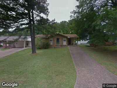
413 Latona Ln North Little Rock, AR 72118
Amboy NeighborhoodEstimated Value: $106,900 - $155,000
--
Bed
3
Baths
1,108
Sq Ft
$118/Sq Ft
Est. Value
About This Home
This home is located at 413 Latona Ln, North Little Rock, AR 72118 and is currently estimated at $130,225, approximately $117 per square foot. 413 Latona Ln is a home located in Pulaski County with nearby schools including Indian Hills Elementary School, North Little Rock Middle School 6th Grade Campus, and North Little Rock High School.
Ownership History
Date
Name
Owned For
Owner Type
Purchase Details
Closed on
Feb 1, 2008
Sold by
Buford Patricia Ann
Bought by
Anderson Cynthia D
Current Estimated Value
Home Financials for this Owner
Home Financials are based on the most recent Mortgage that was taken out on this home.
Original Mortgage
$81,500
Outstanding Balance
$52,578
Interest Rate
6.07%
Mortgage Type
Purchase Money Mortgage
Estimated Equity
$77,647
Purchase Details
Closed on
Jan 11, 2008
Sold by
Buford Pauline P
Bought by
Buford Patricia Ann
Home Financials for this Owner
Home Financials are based on the most recent Mortgage that was taken out on this home.
Original Mortgage
$81,500
Outstanding Balance
$52,578
Interest Rate
6.07%
Mortgage Type
Purchase Money Mortgage
Estimated Equity
$77,647
Create a Home Valuation Report for This Property
The Home Valuation Report is an in-depth analysis detailing your home's value as well as a comparison with similar homes in the area
Home Values in the Area
Average Home Value in this Area
Purchase History
| Date | Buyer | Sale Price | Title Company |
|---|---|---|---|
| Anderson Cynthia D | $82,000 | First Arkansas Title | |
| Buford Patricia Ann | -- | None Available |
Source: Public Records
Mortgage History
| Date | Status | Borrower | Loan Amount |
|---|---|---|---|
| Open | Anderson Cynthia D | $81,500 |
Source: Public Records
Tax History Compared to Growth
Tax History
| Year | Tax Paid | Tax Assessment Tax Assessment Total Assessment is a certain percentage of the fair market value that is determined by local assessors to be the total taxable value of land and additions on the property. | Land | Improvement |
|---|---|---|---|---|
| 2023 | $956 | $20,497 | $3,200 | $17,297 |
| 2022 | $913 | $20,497 | $3,200 | $17,297 |
| 2021 | $869 | $13,010 | $2,300 | $10,710 |
| 2020 | $494 | $13,010 | $2,300 | $10,710 |
| 2019 | $494 | $13,010 | $2,300 | $10,710 |
| 2018 | $519 | $13,010 | $2,300 | $10,710 |
| 2017 | $519 | $13,010 | $2,300 | $10,710 |
| 2016 | $1,146 | $17,150 | $4,320 | $12,830 |
| 2015 | $1,107 | $17,150 | $4,320 | $12,830 |
| 2014 | $1,107 | $16,569 | $4,320 | $12,249 |
Source: Public Records
Map
Nearby Homes
- 6104 Greenbank Rd
- 516 Windhill Dr
- 5900 Meadowbrook Ln
- 503 Tanglewood Dr
- 115 Timberline Dr
- 5910 N Locust St
- 6 Kierre Dr
- 6401 Allwood Dr
- 2 Oakview Dr
- 6 Oakview Dr
- 6075 Allwood Dr
- 5813 N Walnut Rd
- 820 Valley Creek Point
- 5607 Bluebell Dr
- 5512 Maple St
- 6509 Countrywood Cove
- 126 Cobblestone Cir
- 313 Wisteria Dr
- 405 Wisteria Dr
- 1304 Winbourne Dr