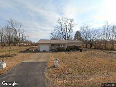
417 County Road 560 Poplar Bluff, MO 63901
Estimated Value: $109,079 - $160,000
--
Bed
--
Bath
1,397
Sq Ft
$102/Sq Ft
Est. Value
About This Home
This home is located at 417 County Road 560, Poplar Bluff, MO 63901 and is currently estimated at $142,270, approximately $101 per square foot. 417 County Road 560 is a home with nearby schools including Poplar Bluff Fifth & Sixth Grade Center, Lake Road Elementary School, and Poplar Bluff Junior High School.
Ownership History
Date
Name
Owned For
Owner Type
Purchase Details
Closed on
Oct 21, 2022
Sold by
Menley Brenda Gail
Bought by
Sample James
Current Estimated Value
Home Financials for this Owner
Home Financials are based on the most recent Mortgage that was taken out on this home.
Original Mortgage
$71,244
Outstanding Balance
$69,158
Interest Rate
5.89%
Mortgage Type
New Conventional
Estimated Equity
$52,936
Purchase Details
Closed on
Sep 12, 2018
Sold by
Menley Brenda Gail
Bought by
Hefner Chales Keith and Dearman Kristi Lynn
Create a Home Valuation Report for This Property
The Home Valuation Report is an in-depth analysis detailing your home's value as well as a comparison with similar homes in the area
Home Values in the Area
Average Home Value in this Area
Purchase History
| Date | Buyer | Sale Price | Title Company |
|---|---|---|---|
| Sample James | -- | Heritage Title |
Source: Public Records
Mortgage History
| Date | Status | Borrower | Loan Amount |
|---|---|---|---|
| Open | Sample James | $71,244 |
Source: Public Records
Tax History Compared to Growth
Tax History
| Year | Tax Paid | Tax Assessment Tax Assessment Total Assessment is a certain percentage of the fair market value that is determined by local assessors to be the total taxable value of land and additions on the property. | Land | Improvement |
|---|---|---|---|---|
| 2024 | $551 | $12,240 | $0 | $0 |
| 2023 | $551 | $12,240 | $0 | $0 |
| 2022 | $533 | $11,860 | $0 | $0 |
| 2021 | $533 | $11,860 | $0 | $0 |
| 2020 | $528 | $11,570 | $0 | $0 |
| 2019 | $528 | $11,570 | $0 | $0 |
| 2018 | $528 | $11,570 | $0 | $0 |
| 2017 | -- | $11,570 | $0 | $0 |
| 2016 | -- | $11,570 | $0 | $0 |
| 2015 | -- | $11,570 | $0 | $0 |
| 2014 | -- | $10,460 | $0 | $0 |
| 2012 | $404 | $10,460 | $0 | $0 |
Source: Public Records
Map
Nearby Homes
- 380 County Road 560
- 247 Harrison Ln
- 0 E of Hwy B Unit MAR24053001
- 626 County Road 603
- 1041 State Highway Aa
- 1043 Highway Aa
- 684 County Road 603
- 0 S Highway B Unit MAR24049647
- 3103 State Highway Aa
- 306 Helen Ave
- 171 Red Robin Ln
- 0 County Road 602
- 0 North St
- 383 Red Robin Ln
- 186 County Road 613
- 513 N E St
- 434 Highway Vv
- 707 Riverview Dr N
- 1002 Clyde Ave
- 316 Euclid Ave