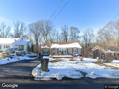
4174 Skyland Dr Kingsport, TN 37664
Estimated Value: $154,480 - $181,000
2
Beds
1
Bath
1,832
Sq Ft
$90/Sq Ft
Est. Value
About This Home
This home is located at 4174 Skyland Dr, Kingsport, TN 37664 and is currently estimated at $165,620, approximately $90 per square foot. 4174 Skyland Dr is a home located in Sullivan County with nearby schools including Andrew Johnson Elementary School, Ross N. Robinson Middle School, and Dobyns-Bennett High School.
Ownership History
Date
Name
Owned For
Owner Type
Purchase Details
Closed on
May 23, 2003
Sold by
Williams Robert L
Bought by
Samuel Roman
Current Estimated Value
Home Financials for this Owner
Home Financials are based on the most recent Mortgage that was taken out on this home.
Original Mortgage
$65,964
Outstanding Balance
$30,134
Interest Rate
5.79%
Estimated Equity
$156,328
Purchase Details
Closed on
Dec 12, 1991
Purchase Details
Closed on
Sep 26, 1990
Create a Home Valuation Report for This Property
The Home Valuation Report is an in-depth analysis detailing your home's value as well as a comparison with similar homes in the area
Home Values in the Area
Average Home Value in this Area
Purchase History
| Date | Buyer | Sale Price | Title Company |
|---|---|---|---|
| Samuel Roman | $67,000 | -- | |
| -- | $37,000 | -- | |
| -- | $26,500 | -- |
Source: Public Records
Mortgage History
| Date | Status | Borrower | Loan Amount |
|---|---|---|---|
| Open | Roman Samuel | $1,598 | |
| Open | Roman Samuel | $6,182 | |
| Open | Roman Samuel | $28,000 | |
| Open | -- | $65,964 | |
| Previous Owner | Robert Williams | $21,800 | |
| Previous Owner | Robert Williams | $42,000 |
Source: Public Records
Tax History Compared to Growth
Tax History
| Year | Tax Paid | Tax Assessment Tax Assessment Total Assessment is a certain percentage of the fair market value that is determined by local assessors to be the total taxable value of land and additions on the property. | Land | Improvement |
|---|---|---|---|---|
| 2024 | -- | $18,375 | $3,725 | $14,650 |
| 2023 | $809 | $18,375 | $3,725 | $14,650 |
| 2022 | $809 | $18,375 | $3,725 | $14,650 |
| 2021 | $787 | $18,375 | $3,725 | $14,650 |
| 2020 | $454 | $18,375 | $3,725 | $14,650 |
| 2019 | $818 | $17,650 | $3,725 | $13,925 |
| 2018 | $799 | $17,650 | $3,725 | $13,925 |
| 2017 | $799 | $17,650 | $3,725 | $13,925 |
| 2016 | $866 | $18,625 | $2,800 | $15,825 |
| 2014 | $815 | $18,627 | $0 | $0 |
Source: Public Records
Map
Nearby Homes
- Tbd Mountain View Ave
- 3912 Memorial Blvd
- 2110 Hawthorne St
- 2122 Hawthorne St
- Lot 16 Morning Star Ct
- Tbd
- Lot 20 Morning Star Dr
- Lot 18 Morning Star Dr
- 2324 Inglewood Dr
- 4016 Skyland Dr
- 2356 Inglewood Dr
- Lot 85 Ashfield Dr
- Lot 4 Hidden Oak Cir
- 4511 Grace Dr
- 4528 Glenbrook Dr
- 3521 Memorial Blvd
- 1229 Cooks Valley Rd
- Tbd Harbor Dr
- 3829 Ridgeline Dr
- 4113 Fox Lair Place