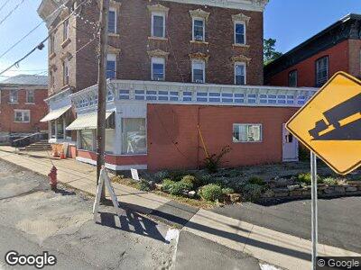
4239 Main St Port Henry, NY 12974
Estimated Value: $160,000 - $300,000
4
Beds
1
Bath
1,878
Sq Ft
$106/Sq Ft
Est. Value
About This Home
This home is located at 4239 Main St, Port Henry, NY 12974 and is currently estimated at $198,411, approximately $105 per square foot. 4239 Main St is a home located in Essex County with nearby schools including Moriah Elementary School and Moriah Junior/Senior High School.
Ownership History
Date
Name
Owned For
Owner Type
Purchase Details
Closed on
Oct 30, 2024
Sold by
Trailnorth Fcu and Macdougal
Bought by
Jerdo Stewart
Current Estimated Value
Purchase Details
Closed on
Aug 19, 2021
Sold by
Mcdougal Christina and Macdougal Scott
Bought by
Mcdougal Christina
Home Financials for this Owner
Home Financials are based on the most recent Mortgage that was taken out on this home.
Original Mortgage
$40,000
Interest Rate
2.7%
Mortgage Type
Stand Alone Refi Refinance Of Original Loan
Purchase Details
Closed on
May 7, 2018
Sold by
Capuano Joseph and Urban Patricia
Bought by
Macdougal Christina and Mcdougal Scott
Create a Home Valuation Report for This Property
The Home Valuation Report is an in-depth analysis detailing your home's value as well as a comparison with similar homes in the area
Home Values in the Area
Average Home Value in this Area
Purchase History
| Date | Buyer | Sale Price | Title Company |
|---|---|---|---|
| Jerdo Stewart | $65,283 | None Available | |
| Mcdougal Christina | $7,500 | None Available | |
| Mcdougal Christina | $7,500 | None Available | |
| Macdougal Christina | $90,000 | -- |
Source: Public Records
Mortgage History
| Date | Status | Borrower | Loan Amount |
|---|---|---|---|
| Previous Owner | Mcdougal Christina | $40,000 |
Source: Public Records
Tax History Compared to Growth
Tax History
| Year | Tax Paid | Tax Assessment Tax Assessment Total Assessment is a certain percentage of the fair market value that is determined by local assessors to be the total taxable value of land and additions on the property. | Land | Improvement |
|---|---|---|---|---|
| 2024 | $3,038 | $97,400 | $29,700 | $67,700 |
| 2023 | $3,038 | $97,400 | $29,700 | $67,700 |
| 2022 | $2,977 | $97,400 | $29,700 | $67,700 |
| 2021 | $3,012 | $97,400 | $29,700 | $67,700 |
| 2020 | $4,733 | $97,400 | $29,700 | $67,700 |
| 2019 | $4,719 | $97,400 | $29,700 | $67,700 |
| 2018 | $3,011 | $91,900 | $28,000 | $63,900 |
| 2017 | $2,986 | $91,900 | $28,000 | $63,900 |
| 2016 | $1,011 | $91,900 | $28,000 | $63,900 |
| 2015 | -- | $91,900 | $28,000 | $63,900 |
| 2014 | -- | $91,900 | $28,000 | $63,900 |
Source: Public Records
Map
Nearby Homes
- 11 Jackson St
- 22 Rice Ln
- 27 Rice Ln
- L16.000 State Highway 9n
- 43 Brook St
- 49 Brook St
- 3098 Broad St
- 17 Tunnel Ave
- 4454 N Main St
- 0 Fisk Rd
- 0 Bridge Rd Unit 11348779
- 0 Bridge Rd Unit 203137
- 60 Cedar Dr
- 2543 Moriah Rd
- 6.000 Lang Rd
- 2842 Plank Rd
- L9 Cold Spring Rd
- 17 Old Port Way
- 220 Fairy Lake Rd
- 0 Plank Rd Unit R1584299