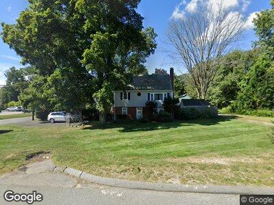
425 S Main St Andover, MA 01810
Estimated Value: $638,000 - $774,000
3
Beds
1
Bath
2,228
Sq Ft
$322/Sq Ft
Est. Value
About This Home
This home is located at 425 S Main St, Andover, MA 01810 and is currently estimated at $717,187, approximately $321 per square foot. 425 S Main St is a home located in Essex County with nearby schools including South Elementary School, Doherty Middle School, and Andover High School.
Ownership History
Date
Name
Owned For
Owner Type
Purchase Details
Closed on
Apr 9, 2004
Sold by
Casper Massey and Casper Rita
Bought by
Mcdonald Debra S and Mcdonald Leonard J
Current Estimated Value
Home Financials for this Owner
Home Financials are based on the most recent Mortgage that was taken out on this home.
Original Mortgage
$318,400
Interest Rate
5.6%
Mortgage Type
Purchase Money Mortgage
Purchase Details
Closed on
Mar 30, 1992
Sold by
Cheney Teresa O
Bought by
Casper Massey
Create a Home Valuation Report for This Property
The Home Valuation Report is an in-depth analysis detailing your home's value as well as a comparison with similar homes in the area
Home Values in the Area
Average Home Value in this Area
Purchase History
| Date | Buyer | Sale Price | Title Company |
|---|---|---|---|
| Mcdonald Debra S | $398,000 | -- | |
| Casper Massey | $157,000 | -- |
Source: Public Records
Mortgage History
| Date | Status | Borrower | Loan Amount |
|---|---|---|---|
| Open | Mcdonald Leonard J | $75,000 | |
| Open | Mcdonald Leonard J | $250,000 | |
| Closed | Mcdonald Debra S | $50,000 | |
| Closed | Casper Massey | $282,314 | |
| Closed | Mcdonald Debra S | $318,400 | |
| Closed | Mcdonald Debra S | $39,800 | |
| Previous Owner | Casper Massey | $212,500 | |
| Previous Owner | Casper Massey | $220,000 | |
| Previous Owner | Casper Massey | $42,601 |
Source: Public Records
Tax History Compared to Growth
Tax History
| Year | Tax Paid | Tax Assessment Tax Assessment Total Assessment is a certain percentage of the fair market value that is determined by local assessors to be the total taxable value of land and additions on the property. | Land | Improvement |
|---|---|---|---|---|
| 2024 | $6,828 | $530,100 | $252,900 | $277,200 |
| 2023 | $6,598 | $483,000 | $234,200 | $248,800 |
| 2022 | $6,204 | $424,900 | $198,600 | $226,300 |
| 2021 | $5,946 | $388,900 | $180,600 | $208,300 |
| 2020 | $5,723 | $381,300 | $176,200 | $205,100 |
| 2019 | $5,658 | $370,500 | $169,400 | $201,100 |
| 2018 | $5,400 | $345,300 | $159,900 | $185,400 |
| 2017 | $5,187 | $341,700 | $156,800 | $184,900 |
| 2016 | $5,082 | $342,900 | $156,800 | $186,100 |
| 2015 | $4,894 | $326,900 | $150,700 | $176,200 |
Source: Public Records
Map
Nearby Homes
- 40 Boston Rd
- 3 Regency Ridge
- 68 Rattlesnake Hill Rd
- 11 Clover Cir
- 4 Peppercorn Ln
- 22 Wildwood Rd
- 7 Skopelos Cir
- 12 Sagamore Dr
- 69 Sunset Rock Rd
- 15 Gould Rd
- 21 Orchard Crossing
- 7 Orchard Crossing
- 326 S Main St
- 6 Dundas Ave
- 17 Enfield Dr
- 3 West Hollow
- 2 Colonial Dr Unit E2-5
- 2 Colonial Dr Unit D2-5
- 60 Colonial Dr Unit 3
- 5 Colonial Dr Unit 2