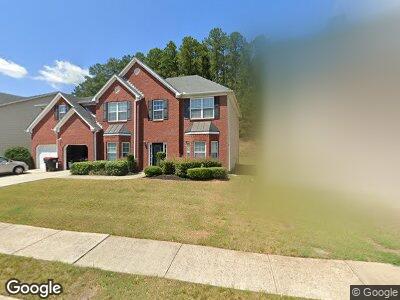
4280 Shamrock Dr Atlanta, GA 30349
Estimated Value: $396,088 - $471,000
5
Beds
4
Baths
4,398
Sq Ft
$101/Sq Ft
Est. Value
About This Home
This home is located at 4280 Shamrock Dr, Atlanta, GA 30349 and is currently estimated at $442,522, approximately $100 per square foot. 4280 Shamrock Dr is a home located in Fulton County with nearby schools including Wolf Creek Elementary, Renaissance Middle School, and Langston Hughes High School.
Ownership History
Date
Name
Owned For
Owner Type
Purchase Details
Closed on
Aug 1, 2008
Sold by
Armstrong Anthony L
Bought by
Armstrong Anthony L and Armstrong Angela D
Current Estimated Value
Home Financials for this Owner
Home Financials are based on the most recent Mortgage that was taken out on this home.
Original Mortgage
$209,856
Interest Rate
6.37%
Mortgage Type
FHA
Create a Home Valuation Report for This Property
The Home Valuation Report is an in-depth analysis detailing your home's value as well as a comparison with similar homes in the area
Home Values in the Area
Average Home Value in this Area
Purchase History
| Date | Buyer | Sale Price | Title Company |
|---|---|---|---|
| Armstrong Anthony L | -- | -- | |
| Armstrong Anthony L | $227,500 | -- |
Source: Public Records
Mortgage History
| Date | Status | Borrower | Loan Amount |
|---|---|---|---|
| Open | Armstrong Anthony Lee | $163,234 | |
| Closed | Armstrong Anthony L | $10,353 | |
| Closed | Armstrong Anthony L | $209,856 |
Source: Public Records
Tax History Compared to Growth
Tax History
| Year | Tax Paid | Tax Assessment Tax Assessment Total Assessment is a certain percentage of the fair market value that is determined by local assessors to be the total taxable value of land and additions on the property. | Land | Improvement |
|---|---|---|---|---|
| 2023 | $3,013 | $106,760 | $19,720 | $87,040 |
| 2022 | $2,557 | $106,760 | $19,720 | $87,040 |
| 2021 | $2,522 | $103,640 | $19,160 | $84,480 |
| 2020 | $2,532 | $102,400 | $18,920 | $83,480 |
| 2019 | $2,541 | $89,640 | $19,320 | $70,320 |
| 2018 | $2,519 | $80,600 | $11,920 | $68,680 |
| 2017 | $2,108 | $68,800 | $9,920 | $58,880 |
| 2016 | $2,107 | $68,800 | $9,920 | $58,880 |
| 2015 | $2,113 | $68,800 | $9,920 | $58,880 |
| 2014 | $2,202 | $68,800 | $9,920 | $58,880 |
Source: Public Records
Map
Nearby Homes
- 220 Tracewind Place
- 4379 Shamrock Dr
- 4205 Post Oak Grove
- 4160 Post Oak Grove
- 4270 Holliday Rd
- 4360 Derrick Rd
- 0 Derrick Rd SE Unit 10340429
- 6390 E Stubbs Rd
- 4369 Estate St
- 4394 Estate St
- 6476 Snowden Dr
- 4020 Cranwood Dr Unit 1
- 6445 Marsham Dr
- 6640 E Stubbs Rd
- 6834 Fireside Ln
- 4300 Watauga Dr
- 115 Hollybrook Rd
- 6849 Fireside Ln