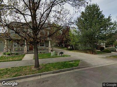
431 Silver Creek Dr Central Point, OR 97502
Griffin Oaks NeighborhoodEstimated Value: $483,270 - $523,000
3
Beds
3
Baths
2,500
Sq Ft
$199/Sq Ft
Est. Value
About This Home
This home is located at 431 Silver Creek Dr, Central Point, OR 97502 and is currently estimated at $497,568, approximately $199 per square foot. 431 Silver Creek Dr is a home located in Jackson County with nearby schools including Richardson Elementary School, Scenic Middle School, and Crater High School.
Ownership History
Date
Name
Owned For
Owner Type
Purchase Details
Closed on
Nov 24, 2018
Sold by
Flangan Clark Kathleen A
Bought by
Flanagan Clark Kathleen A and The Kathleen A Flanagan Clark
Current Estimated Value
Purchase Details
Closed on
Mar 19, 2003
Sold by
Wl Moore Construction Co
Bought by
Flanagan Clark Kathleen A
Home Financials for this Owner
Home Financials are based on the most recent Mortgage that was taken out on this home.
Original Mortgage
$119,000
Interest Rate
5.82%
Create a Home Valuation Report for This Property
The Home Valuation Report is an in-depth analysis detailing your home's value as well as a comparison with similar homes in the area
Home Values in the Area
Average Home Value in this Area
Purchase History
| Date | Buyer | Sale Price | Title Company |
|---|---|---|---|
| Flanagan Clark Kathleen A | -- | None Available | |
| Flanagan Clark Kathleen A | $198,000 | Key Title Company | |
| Wl Moore Construction Co | $44,100 | Key Title Company |
Source: Public Records
Mortgage History
| Date | Status | Borrower | Loan Amount |
|---|---|---|---|
| Previous Owner | Flanagan Clark Kathleen A | $112,760 | |
| Previous Owner | Flanagan Clark Kathleen A | $113,800 | |
| Previous Owner | Flanagan Clark Kathleen A | $119,000 | |
| Closed | Flanagan Clark Kathleen A | $30,000 |
Source: Public Records
Tax History Compared to Growth
Tax History
| Year | Tax Paid | Tax Assessment Tax Assessment Total Assessment is a certain percentage of the fair market value that is determined by local assessors to be the total taxable value of land and additions on the property. | Land | Improvement |
|---|---|---|---|---|
| 2024 | $4,472 | $261,160 | $116,900 | $144,260 |
| 2023 | $4,328 | $253,560 | $113,500 | $140,060 |
| 2022 | $4,227 | $253,560 | $113,500 | $140,060 |
| 2021 | $4,107 | $246,180 | $110,190 | $135,990 |
| 2020 | $3,987 | $239,010 | $106,980 | $132,030 |
| 2019 | $3,889 | $225,300 | $100,850 | $124,450 |
| 2018 | $3,770 | $218,740 | $97,920 | $120,820 |
| 2017 | $3,675 | $218,740 | $97,920 | $120,820 |
| 2016 | $3,568 | $206,190 | $92,300 | $113,890 |
| 2015 | $3,418 | $206,190 | $92,300 | $113,890 |
| 2014 | $3,332 | $194,360 | $87,000 | $107,360 |
Source: Public Records
Map
Nearby Homes
- 4025 Sunland Ave
- 669 Silver Creek Dr Unit 2
- 781 Silver Creek Dr Unit 2
- 2161 Taylor Rd Unit 3
- 316 Donna Way
- 2495 Taylor Rd
- 660 Valley Oak Blvd
- 619 Palo Verde Way
- 511 Blue Moon Dr
- 548 Blue Heron Dr
- 1114 Twin Creeks Crossing
- 573 Blue Heron Dr
- 658 Golden Peak Dr
- 1148 Grouse Ridge Dr
- 429 Mayberry Ln
- 0 Boulder Ridge St
- 441 N 1st St Unit 441-439
- 864 Mendolia Way
- 1128 Boulder Ridge St
- 202 Corcoran Ln