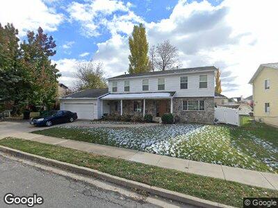
431 W 950 N Centerville, UT 84014
Estimated Value: $625,000 - $653,756
6
Beds
3
Baths
2,809
Sq Ft
$229/Sq Ft
Est. Value
About This Home
This home is located at 431 W 950 N, Centerville, UT 84014 and is currently estimated at $642,439, approximately $228 per square foot. 431 W 950 N is a home located in Davis County with nearby schools including Stewart Elementary School, Centerville Jr High, and Viewmont High School.
Ownership History
Date
Name
Owned For
Owner Type
Purchase Details
Closed on
Oct 25, 2024
Sold by
Payne Nathan B and Payne Kelly C
Bought by
Nathan And Kelly Payne Asset Protection Trust and Cook
Current Estimated Value
Purchase Details
Closed on
Jul 21, 2022
Sold by
Garth Green Rodney and Ward Cathryn
Bought by
Payne Nathan B and Payne Kelly C
Home Financials for this Owner
Home Financials are based on the most recent Mortgage that was taken out on this home.
Original Mortgage
$486,750
Interest Rate
5.7%
Mortgage Type
New Conventional
Create a Home Valuation Report for This Property
The Home Valuation Report is an in-depth analysis detailing your home's value as well as a comparison with similar homes in the area
Home Values in the Area
Average Home Value in this Area
Purchase History
| Date | Buyer | Sale Price | Title Company |
|---|---|---|---|
| Nathan And Kelly Payne Asset Protection Trust | -- | None Listed On Document | |
| Payne Nathan B | -- | Pinnacle Title |
Source: Public Records
Mortgage History
| Date | Status | Borrower | Loan Amount |
|---|---|---|---|
| Previous Owner | Payne Nathan B | $486,750 |
Source: Public Records
Tax History Compared to Growth
Tax History
| Year | Tax Paid | Tax Assessment Tax Assessment Total Assessment is a certain percentage of the fair market value that is determined by local assessors to be the total taxable value of land and additions on the property. | Land | Improvement |
|---|---|---|---|---|
| 2024 | $3,427 | $306,350 | $145,372 | $160,978 |
| 2023 | $3,021 | $531,000 | $238,855 | $292,145 |
| 2022 | $2,994 | $289,850 | $120,528 | $169,322 |
| 2021 | $2,673 | $403,000 | $183,448 | $219,552 |
| 2020 | $2,302 | $347,000 | $179,462 | $167,538 |
| 2019 | $2,343 | $345,000 | $180,864 | $164,136 |
| 2018 | $2,179 | $317,000 | $167,879 | $149,121 |
| 2016 | $1,821 | $147,235 | $53,569 | $93,666 |
| 2015 | $1,785 | $136,125 | $53,569 | $82,556 |
| 2014 | $1,857 | $144,942 | $53,569 | $91,373 |
| 2013 | -- | $147,863 | $47,025 | $100,838 |
Source: Public Records
Map
Nearby Homes
- 456 W 950 N
- 892 N 400 W
- 269 Park Ln
- 271 Brookfield Ln
- 231 Meadow Ln
- 712 W Chase Ln
- 386 W 1125 N
- 225 W 925 N
- 1176 N 400 W
- 203 W Pheasantbrook Dr
- 677 N 310 W
- 147 W 925 N
- 1165 N 725 W
- 128 Pheasantbrook Dr
- 290 W 650 N
- 684 N 800 W
- 105 W Pheasantbrook Dr
- 81 Pheasantbrook Dr
- 851 Pheasantbrook Cir
- 34 Creekside Ln