Estimated Value: $2,445,469 - $4,722,000
2
Beds
3
Baths
1,086
Sq Ft
$3,029/Sq Ft
Est. Value
About This Home
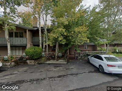
This home is located at 433 Gore Creek Dr Unit 16A, Vail, CO 81657 and is currently estimated at $3,289,367, approximately $3,028 per square foot. 433 Gore Creek Dr Unit 16A is a home located in Eagle County with nearby schools including Red Sandstone Elementary School, Battle Mountain High School, and Vail Mountain School.
Ownership History
Date
Name
Owned For
Owner Type
Purchase Details
Closed on
Mar 21, 2012
Sold by
Mahoney Mark B
Bought by
Gulf Stream Investment Holdings Inc
Current Estimated Value
Purchase Details
Closed on
Feb 23, 2012
Sold by
Mahoney Noelle S
Bought by
Mahoney Mark B
Purchase Details
Closed on
Dec 13, 2007
Sold by
Albrecht Susan E
Bought by
Mahoney Mark B and Mahoney Noelle S
Home Financials for this Owner
Home Financials are based on the most recent Mortgage that was taken out on this home.
Original Mortgage
$1,413,750
Interest Rate
6.75%
Mortgage Type
Purchase Money Mortgage
Purchase Details
Closed on
Dec 8, 2007
Sold by
Albrecht Family Partnership Lllp
Bought by
Albrecht Susan E and Oneil James E
Home Financials for this Owner
Home Financials are based on the most recent Mortgage that was taken out on this home.
Original Mortgage
$1,413,750
Interest Rate
6.75%
Mortgage Type
Purchase Money Mortgage
Create a Home Valuation Report for This Property
The Home Valuation Report is an in-depth analysis detailing your home's value as well as a comparison with similar homes in the area
Home Values in the Area
Average Home Value in this Area
Purchase History
| Date | Buyer | Sale Price | Title Company |
|---|---|---|---|
| Gulf Stream Investment Holdings Inc | -- | None Available | |
| Mahoney Mark B | -- | None Available | |
| Mahoney Mark B | $2,175,000 | Stewart Title | |
| Albrecht Susan E | -- | Stewart Title |
Source: Public Records
Mortgage History
| Date | Status | Borrower | Loan Amount |
|---|---|---|---|
| Previous Owner | Mahoney Mark B | $840,000 | |
| Previous Owner | Mahoney Mark B | $1,413,750 |
Source: Public Records
Tax History Compared to Growth
Tax History
| Year | Tax Paid | Tax Assessment Tax Assessment Total Assessment is a certain percentage of the fair market value that is determined by local assessors to be the total taxable value of land and additions on the property. | Land | Improvement |
|---|---|---|---|---|
| 2024 | $6,170 | $129,730 | -- | $129,730 |
| 2023 | $6,170 | $129,730 | $0 | $129,730 |
| 2022 | $6,004 | $116,840 | $0 | $116,840 |
| 2021 | $6,183 | $120,210 | $0 | $120,210 |
| 2020 | $6,101 | $120,210 | $0 | $120,210 |
| 2019 | $6,121 | $120,210 | $0 | $120,210 |
| 2018 | $5,609 | $107,970 | $0 | $107,970 |
| 2017 | $5,582 | $107,970 | $0 | $107,970 |
| 2016 | $5,907 | $115,520 | $0 | $115,520 |
| 2015 | -- | $115,520 | $0 | $115,520 |
| 2014 | $4,819 | $102,510 | $0 | $102,510 |
Source: Public Records
Map
Nearby Homes
- 442 S Frontage Rd E Unit 306
- 430 S Frontage Rd E Unit 301
- 430 S Frontage Rd E Unit RU-C
- 500 S Frontage Rd E Unit 303
- 384 Gore Creek Dr Unit 9
- 595 Vail Valley Dr Unit 162D
- 595 Vail Valley Dr Unit 115
- 352 E Meadow Dr Unit H
- 352 E Meadow Dr Unit K
- 352 E Meadow Dr Unit J
- 352 E Meadow Dr Unit E
- 292 E Meadow Dr Unit 558
- 292 E Meadow Dr Unit 329
- 292 E Meadow Dr Unit 569
- 292 E Meadow Dr Unit 106
- 242 E Meadow Dr Unit 202-4
- 242 E Meadow Dr Unit 201-5
- 242 E Meadow Dr Unit 203-6
- 242 E Meadow Dr Unit 400-2
- 242 E Meadow Dr Unit 401-6