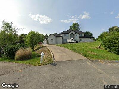
439 Independence Ct Uniontown, PA 15401
Estimated Value: $366,000 - $623,000
4
Beds
4
Baths
4,103
Sq Ft
$125/Sq Ft
Est. Value
About This Home
This home is located at 439 Independence Ct, Uniontown, PA 15401 and is currently estimated at $514,102, approximately $125 per square foot. 439 Independence Ct is a home located in Fayette County with nearby schools including Laurel Highlands Senior High School, St. John the Evangelist School, and Chestnut Ridge Christian Academy.
Ownership History
Date
Name
Owned For
Owner Type
Purchase Details
Closed on
Apr 5, 2023
Sold by
First Federal Savings And Loan Associati
Bought by
Sabatini Dominic A and Sabatini April D
Current Estimated Value
Home Financials for this Owner
Home Financials are based on the most recent Mortgage that was taken out on this home.
Original Mortgage
$280,000
Outstanding Balance
$274,668
Interest Rate
6.5%
Mortgage Type
New Conventional
Estimated Equity
$266,356
Purchase Details
Closed on
Nov 15, 2021
Sold by
Zeglen John M and Zeglen Diane L
Bought by
First Fsla Of Greene Cnty
Purchase Details
Closed on
May 16, 1991
Bought by
Zeglen John M and Zeglen Diane L
Create a Home Valuation Report for This Property
The Home Valuation Report is an in-depth analysis detailing your home's value as well as a comparison with similar homes in the area
Home Values in the Area
Average Home Value in this Area
Purchase History
| Date | Buyer | Sale Price | Title Company |
|---|---|---|---|
| Sabatini Dominic A | $350,000 | None Listed On Document | |
| First Fsla Of Greene Cnty | $1,248 | None Available | |
| Zeglen John M | $35,200 | -- |
Source: Public Records
Mortgage History
| Date | Status | Borrower | Loan Amount |
|---|---|---|---|
| Open | Sabatini Dominic A | $100,000 | |
| Open | Sabatini Dominic A | $280,000 | |
| Previous Owner | Zeglen John M | $110,000 |
Source: Public Records
Tax History Compared to Growth
Tax History
| Year | Tax Paid | Tax Assessment Tax Assessment Total Assessment is a certain percentage of the fair market value that is determined by local assessors to be the total taxable value of land and additions on the property. | Land | Improvement |
|---|---|---|---|---|
| 2024 | $5,780 | $208,430 | $25,245 | $183,185 |
| 2023 | $11,117 | $208,430 | $25,245 | $183,185 |
| 2022 | $11,013 | $208,430 | $25,245 | $183,185 |
| 2021 | $10,707 | $208,430 | $25,245 | $183,185 |
| 2020 | $10,707 | $208,430 | $25,245 | $183,185 |
| 2019 | $9,831 | $208,430 | $25,245 | $183,185 |
| 2018 | $9,534 | $208,430 | $25,245 | $183,185 |
| 2017 | $9,534 | $208,430 | $25,245 | $183,185 |
| 2016 | -- | $208,430 | $25,245 | $183,185 |
| 2015 | -- | $208,430 | $25,245 | $183,185 |
| 2014 | -- | $416,860 | $50,490 | $366,370 |
Source: Public Records
Map
Nearby Homes
- 350 N Saratoga Dr
- 105 Concord Place
- 40 Oconnell Ave
- 60 Heritage Hills Rd
- 87 Farmview Dr
- 70 Heritage Hills Rd
- 409 Derrick Ave
- 4 Mayflower Dr
- 26 Holly Ln
- 160 Brownfield Ln
- 410 Dove Dr
- 1379 Brownfield Rd
- 1104 Cross Creek Dr
- 121 Franklin Ave
- 67 Emerson St
- 0 Brownfield Rd Unit 1659605
- 0 Brownfield Rd Unit 10155044
- 118 Old Walnut Hill Rd
- 52 Emerson St
- 15 Trump Ave