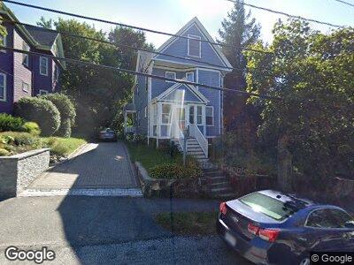
45 Westmoreland Ave Arlington, MA 02474
Arlington Heights NeighborhoodEstimated Value: $993,000 - $1,248,000
3
Beds
2
Baths
1,507
Sq Ft
$711/Sq Ft
Est. Value
About This Home
This home is located at 45 Westmoreland Ave, Arlington, MA 02474 and is currently estimated at $1,071,287, approximately $710 per square foot. 45 Westmoreland Ave is a home located in Middlesex County with nearby schools including Peirce Elementary School, Ottoson Middle School, and Arlington High School.
Ownership History
Date
Name
Owned For
Owner Type
Purchase Details
Closed on
Apr 29, 2005
Sold by
Jennings Linda G and Jennings William H
Bought by
Revelle Cynthia M and Revelle Rodger David
Current Estimated Value
Home Financials for this Owner
Home Financials are based on the most recent Mortgage that was taken out on this home.
Original Mortgage
$408,000
Interest Rate
5.82%
Create a Home Valuation Report for This Property
The Home Valuation Report is an in-depth analysis detailing your home's value as well as a comparison with similar homes in the area
Home Values in the Area
Average Home Value in this Area
Purchase History
| Date | Buyer | Sale Price | Title Company |
|---|---|---|---|
| Revelle Cynthia M | $549,000 | -- |
Source: Public Records
Mortgage History
| Date | Status | Borrower | Loan Amount |
|---|---|---|---|
| Open | Rodger David P | $250,000 | |
| Closed | Rodger David P | $371,000 | |
| Closed | Jennings William H | $380,000 | |
| Closed | Jennings William H | $388,000 | |
| Closed | Revelle Cynthia M | $408,000 | |
| Closed | Revelle Cynthia M | $379,200 | |
| Closed | Revelle Cynthia M | $60,000 | |
| Previous Owner | Jennings William H | $80,000 | |
| Previous Owner | Jennings William H | $54,700 |
Source: Public Records
Tax History Compared to Growth
Tax History
| Year | Tax Paid | Tax Assessment Tax Assessment Total Assessment is a certain percentage of the fair market value that is determined by local assessors to be the total taxable value of land and additions on the property. | Land | Improvement |
|---|---|---|---|---|
| 2025 | $10,297 | $956,100 | $456,000 | $500,100 |
| 2024 | $9,393 | $887,000 | $438,900 | $448,100 |
| 2023 | $9,414 | $839,800 | $410,400 | $429,400 |
| 2022 | $8,998 | $787,900 | $399,000 | $388,900 |
| 2021 | $8,807 | $776,600 | $399,000 | $377,600 |
| 2020 | $8,589 | $776,600 | $399,000 | $377,600 |
| 2019 | $7,718 | $685,400 | $393,300 | $292,100 |
| 2018 | $7,208 | $594,200 | $302,100 | $292,100 |
| 2017 | $7,248 | $577,100 | $285,000 | $292,100 |
| 2016 | $7,095 | $554,300 | $262,200 | $292,100 |
| 2015 | $7,058 | $520,900 | $245,100 | $275,800 |
Source: Public Records
Map
Nearby Homes
- 181 Lowell St
- 33 Montague St
- 132 Lowell St
- 48 Lowell St
- 595 Summer St
- 62 Paul Revere Rd
- 1 Watermill Place Unit 527
- 1 Watermill Place Unit 320
- 1 Watermill Place Unit 304
- 97 Sunset Rd
- 33 Argyle Rd Unit 33
- 10 Huntington Rd
- 30 Bow St Unit 1
- 8 Sylvia St
- 27 Hancock St
- 32 Brand St
- 40-42 Forest St Unit 40
- 42 Forest St Unit 42
- 31 Lillian Rd
- 1205 Massachusetts Ave