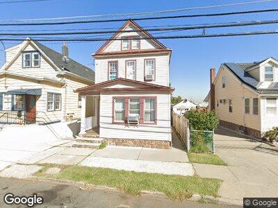
450 Bruck Ave Perth Amboy, NJ 08861
Maurer NeighborhoodEstimated Value: $327,528 - $439,000
--
Bed
--
Bath
1,420
Sq Ft
$288/Sq Ft
Est. Value
About This Home
This home is located at 450 Bruck Ave, Perth Amboy, NJ 08861 and is currently estimated at $408,632, approximately $287 per square foot. 450 Bruck Ave is a home located in Middlesex County with nearby schools including Perth Amboy High School, Middlesex County STEM Charter School, and Academy for Urban Leadership Charter School.
Ownership History
Date
Name
Owned For
Owner Type
Purchase Details
Closed on
Jun 22, 2009
Sold by
Hernandez Francisco and Hernandez Maria
Bought by
Hernandez Francisco
Current Estimated Value
Purchase Details
Closed on
Mar 13, 1995
Sold by
Valazquez Angel
Bought by
Hernandez Fracisco and Hernandez Maria
Home Financials for this Owner
Home Financials are based on the most recent Mortgage that was taken out on this home.
Original Mortgage
$72,000
Interest Rate
8.89%
Create a Home Valuation Report for This Property
The Home Valuation Report is an in-depth analysis detailing your home's value as well as a comparison with similar homes in the area
Home Values in the Area
Average Home Value in this Area
Purchase History
| Date | Buyer | Sale Price | Title Company |
|---|---|---|---|
| Hernandez Francisco | -- | None Available | |
| Hernandez Fracisco | $90,000 | -- |
Source: Public Records
Mortgage History
| Date | Status | Borrower | Loan Amount |
|---|---|---|---|
| Open | Hernandez Francisco | $166,000 | |
| Closed | Hernandez Francisco | $170,000 | |
| Closed | Hernandez Fracisco | $72,000 |
Source: Public Records
Tax History Compared to Growth
Tax History
| Year | Tax Paid | Tax Assessment Tax Assessment Total Assessment is a certain percentage of the fair market value that is determined by local assessors to be the total taxable value of land and additions on the property. | Land | Improvement |
|---|---|---|---|---|
| 2024 | $5,609 | $186,300 | $86,400 | $99,900 |
| 2023 | $5,609 | $186,300 | $86,400 | $99,900 |
| 2022 | $5,542 | $186,300 | $86,400 | $99,900 |
| 2021 | $5,550 | $186,300 | $86,400 | $99,900 |
| 2020 | $5,548 | $186,300 | $86,400 | $99,900 |
| 2019 | $5,569 | $186,300 | $86,400 | $99,900 |
| 2018 | $5,520 | $186,300 | $86,400 | $99,900 |
| 2017 | $5,509 | $186,300 | $86,400 | $99,900 |
| 2016 | $5,365 | $186,300 | $86,400 | $99,900 |
| 2015 | $5,403 | $186,300 | $86,400 | $99,900 |
| 2014 | $5,436 | $186,300 | $86,400 | $99,900 |
Source: Public Records
Map
Nearby Homes
- 434 Lawrence St Unit 12
- 434 Lawrence St Unit 6
- 434 Lawrence St Unit 15
- 900 Amboy Ave
- 507 S Park Dr
- 379 Ashley St
- 424 Thomas St
- 757 Chester St
- 381 Keene St
- 531 N Park Dr
- 336 Lawrence St
- 359 Thomas St
- 537 Harding Ave
- 364 Myrtle St
- 865 Kreil St
- 308 Keene St
- 745 Donald Ave
- 694 Mary St
- 718 Convery Blvd
- 863 State St