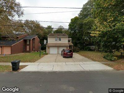
452 High St Long Branch, NJ 07740
West End NeighborhoodEstimated Value: $571,000 - $617,552
3
Beds
3
Baths
1,550
Sq Ft
$378/Sq Ft
Est. Value
About This Home
This home is located at 452 High St, Long Branch, NJ 07740 and is currently estimated at $585,888, approximately $377 per square foot. 452 High St is a home located in Monmouth County with nearby schools including Long Branch High School, Holy Trinity School, and Bet Yaakov of the Jersey Shore.
Ownership History
Date
Name
Owned For
Owner Type
Purchase Details
Closed on
Sep 15, 2000
Sold by
Eddy John
Bought by
Wike Samuel and Wike Rosanne
Current Estimated Value
Home Financials for this Owner
Home Financials are based on the most recent Mortgage that was taken out on this home.
Original Mortgage
$165,000
Interest Rate
8%
Create a Home Valuation Report for This Property
The Home Valuation Report is an in-depth analysis detailing your home's value as well as a comparison with similar homes in the area
Home Values in the Area
Average Home Value in this Area
Purchase History
| Date | Buyer | Sale Price | Title Company |
|---|---|---|---|
| Wike Samuel | $185,000 | -- |
Source: Public Records
Mortgage History
| Date | Status | Borrower | Loan Amount |
|---|---|---|---|
| Open | Wike Samuel E | $357,000 | |
| Closed | Wike Rosanne | $172,803 | |
| Closed | Wike Samuel | $165,000 |
Source: Public Records
Tax History Compared to Growth
Tax History
| Year | Tax Paid | Tax Assessment Tax Assessment Total Assessment is a certain percentage of the fair market value that is determined by local assessors to be the total taxable value of land and additions on the property. | Land | Improvement |
|---|---|---|---|---|
| 2024 | $7,251 | $491,400 | $171,200 | $320,200 |
| 2023 | $7,251 | $466,900 | $161,200 | $305,700 |
| 2022 | $7,250 | $387,800 | $118,500 | $269,300 |
| 2021 | $7,292 | $362,300 | $110,500 | $251,800 |
| 2020 | $7,292 | $348,900 | $98,500 | $250,400 |
| 2019 | $7,046 | $335,200 | $96,500 | $238,700 |
| 2018 | $6,860 | $324,500 | $94,500 | $230,000 |
| 2017 | $6,535 | $317,100 | $91,500 | $225,600 |
| 2016 | $6,332 | $313,300 | $93,500 | $219,800 |
| 2015 | $7,131 | $320,200 | $89,100 | $231,100 |
| 2014 | $6,802 | $321,900 | $99,900 | $222,000 |
Source: Public Records
Map
Nearby Homes
- 364 Westwood Ave Unit 50
- 364 Westwood Ave Unit 91
- 364 Westwood Ave Unit 23
- 364 Westwood Ave Unit 44
- 421 Westbourne Ave
- 546 Winter St
- 537 Winter St
- 303 Westwood Ave
- 441 Division St
- 214 Cleveland Ave
- 215 Cleveland Ave
- 487 Westwood Ave
- 495 Westwood Ave
- 458 W End Ave
- 105 Norwood Ave
- 317 Morris Ave
- 518 Westwood Ave
- 511 Westwood Ave
- 387 Brighton Ave
- 264 Norwood Ave