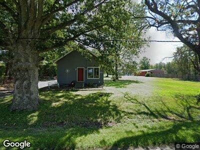
4520 Fort Daniel Rd Decatur, IL 62521
Estimated Value: $86,000 - $100,973
--
Bed
--
Bath
864
Sq Ft
$111/Sq Ft
Est. Value
About This Home
This home is located at 4520 Fort Daniel Rd, Decatur, IL 62521 and is currently estimated at $95,743, approximately $110 per square foot. 4520 Fort Daniel Rd is a home located in Macon County with nearby schools including McGaughey Elementary School, Mt. Zion Intermediate School, and Mt. Zion Elementary School.
Ownership History
Date
Name
Owned For
Owner Type
Purchase Details
Closed on
Jul 9, 2024
Sold by
Mccoy Charles and Mccoy Elayne
Bought by
Mccoy Jon and Mccoy Connie
Current Estimated Value
Purchase Details
Closed on
Mar 28, 2017
Sold by
Mathes Timothy and Mathes Terri
Bought by
Mccoy Charles and Mccoy Elayne
Purchase Details
Closed on
Apr 23, 2013
Sold by
May William J
Bought by
Mathes Timothy and Mathes Terri
Purchase Details
Closed on
Apr 1, 2003
Create a Home Valuation Report for This Property
The Home Valuation Report is an in-depth analysis detailing your home's value as well as a comparison with similar homes in the area
Home Values in the Area
Average Home Value in this Area
Purchase History
| Date | Buyer | Sale Price | Title Company |
|---|---|---|---|
| Mccoy Jon | $22,000 | None Listed On Document | |
| Mccoy Charles | -- | None Available | |
| Mathes Timothy | $51,000 | None Available | |
| -- | $46,000 | -- |
Source: Public Records
Tax History Compared to Growth
Tax History
| Year | Tax Paid | Tax Assessment Tax Assessment Total Assessment is a certain percentage of the fair market value that is determined by local assessors to be the total taxable value of land and additions on the property. | Land | Improvement |
|---|---|---|---|---|
| 2023 | $1,109 | $15,964 | $5,627 | $10,337 |
| 2022 | $1,065 | $15,142 | $5,338 | $9,804 |
| 2021 | $1,033 | $14,185 | $5,000 | $9,185 |
| 2020 | $1,095 | $15,255 | $6,271 | $8,984 |
| 2019 | $1,095 | $15,255 | $6,271 | $8,984 |
| 2018 | $1,068 | $14,866 | $6,111 | $8,755 |
| 2017 | $618 | $14,581 | $5,994 | $8,587 |
| 2016 | $603 | $14,328 | $5,890 | $8,438 |
| 2015 | $581 | $14,186 | $5,832 | $8,354 |
| 2014 | $569 | $14,186 | $5,832 | $8,354 |
| 2013 | $995 | $14,186 | $5,832 | $8,354 |
Source: Public Records
Map
Nearby Homes
- 4757 Rustic Ln
- 4890 Rustic Ln
- 5145 Goodwin Ct
- 8302 Goodwin Cir
- 8299 Goodwin Cir
- 690 Emerald Ave
- 1435 E Ashland Ave
- 2455 S 70th St
- 425 Maddox Dr
- 820 Mintler Dr
- 6455 Birchwood Ln
- 1505 August Hill Place
- 145 W Roberts Dr
- 305 North Dr
- 580 Fawn Ct
- 615 Woodland Dr
- 1610 Brentwood Ct
- 705 W Wildwood Dr
- 355 S Henderson St
- 830 Crestview Dr