4525 Flowers Rd Mansfield, OH 44903
Estimated Value: $242,000 - $397,655
3
Beds
3
Baths
2,496
Sq Ft
$127/Sq Ft
Est. Value
About This Home
This home is located at 4525 Flowers Rd, Mansfield, OH 44903 and is currently estimated at $317,914, approximately $127 per square foot. 4525 Flowers Rd is a home located in Richland County with nearby schools including Stingel Elementary School, Ontario Middle School, and Ontario High School.
Ownership History
Date
Name
Owned For
Owner Type
Purchase Details
Closed on
Aug 5, 1998
Sold by
Gillam Lonnie
Bought by
Snyder Michael and Snyder Joy
Current Estimated Value
Create a Home Valuation Report for This Property
The Home Valuation Report is an in-depth analysis detailing your home's value as well as a comparison with similar homes in the area
Home Values in the Area
Average Home Value in this Area
Purchase History
| Date | Buyer | Sale Price | Title Company |
|---|---|---|---|
| Snyder Michael | $28,000 | -- |
Source: Public Records
Mortgage History
| Date | Status | Borrower | Loan Amount |
|---|---|---|---|
| Open | Snyder Michael A | $35,000 | |
| Closed | Snyder Michael A | $25,000 | |
| Open | Snyder Michael A | $251,000 | |
| Closed | Snyder Michael A | $210,000 | |
| Closed | Snyder Michael A | $200,000 | |
| Closed | Snyder Michael A | $13,897 |
Source: Public Records
Tax History Compared to Growth
Tax History
| Year | Tax Paid | Tax Assessment Tax Assessment Total Assessment is a certain percentage of the fair market value that is determined by local assessors to be the total taxable value of land and additions on the property. | Land | Improvement |
|---|---|---|---|---|
| 2024 | $5,018 | $100,540 | $13,610 | $86,930 |
| 2023 | $5,018 | $100,540 | $13,610 | $86,930 |
| 2022 | $4,798 | $82,710 | $12,380 | $70,330 |
| 2021 | $4,807 | $82,710 | $12,380 | $70,330 |
| 2020 | $5,131 | $82,710 | $12,380 | $70,330 |
| 2019 | $4,831 | $70,470 | $10,490 | $59,980 |
| 2018 | $4,103 | $70,470 | $10,490 | $59,980 |
| 2017 | $4,038 | $70,470 | $10,490 | $59,980 |
| 2016 | $3,695 | $64,160 | $10,170 | $53,990 |
| 2015 | $3,692 | $64,160 | $10,170 | $53,990 |
| 2014 | $3,699 | $64,160 | $10,170 | $53,990 |
| 2012 | $3,414 | $66,150 | $10,490 | $55,660 |
Source: Public Records
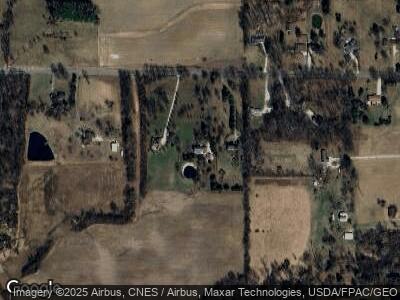
Map
Nearby Homes
- 847 S Horning Rd
- 3821 Horizon Dr
- 445 Rudy Rd
- 570 Earick Rd
- 4662 State Route 181
- 0 Rudy Rd
- 56 Lexington Ontario Rd
- 3606 Park Ave W
- 648 Shelby Ontario Rd
- 895 State Route 314 N
- 1054 Walcrest Dr
- 3626 W 4th St
- 3552 W 4th St
- 776 Lexington Ontario Rd
- 1394 Angus Dr
- 1400 Charolais Dr
- 3158 Hemlock Place
- 5395 Lincoln Hwy
- 2695 Millsboro Rd E
- 324 Bauer Ave