45292 Big Lake Rd McArthur, CA 96056
Highlights
- Panoramic View
- 10 Acre Lot
- Level Lot
About This Lot
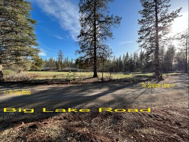
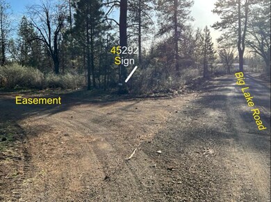
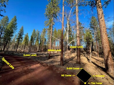
As of July 2024!!! 10 Acre's !!! butted up next to BLM with friendly neighbors that are a fair distance away allowing for peace and solitude. This property has a lot of potential, with easy access from three locations: Big Lake Road, Spencer Lane, and an easement road that is nice enough a sports car can use it.
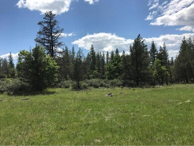
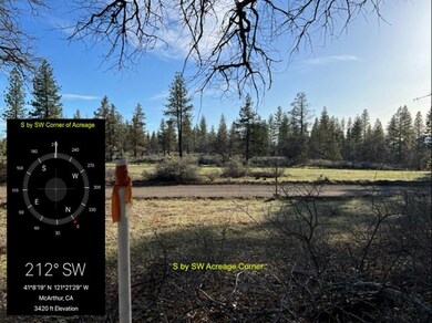
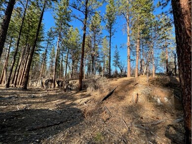
This beautiful property has three levels to it, where the top level sits at about 3,420 feet, and the lower level sits at about 3,370 feet, with the middle level roughly in the middle of the two elevations. The middle level would be a nice secluded location to place a cabin if that is your hearts desire.
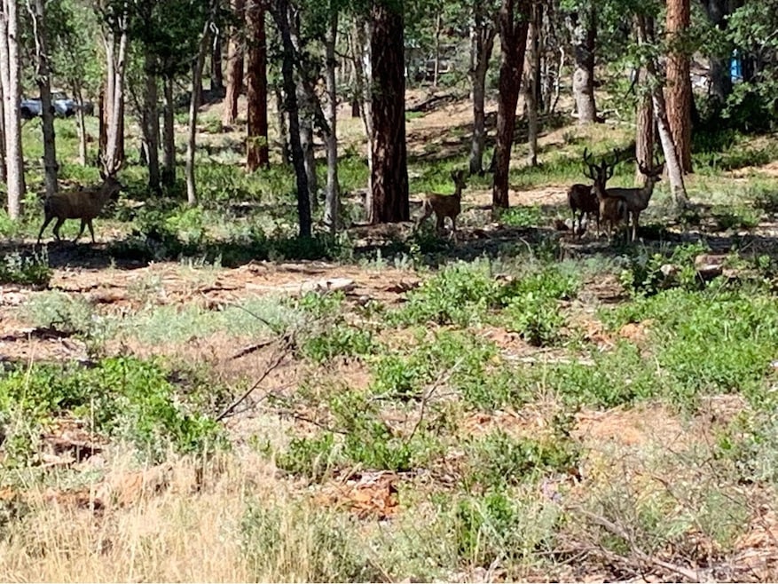
Two herds of deer travel across the property, one herd on the upper level, and one herd that likes to eat and rest in the lower level.
Property Details
Property Type
- Land
Est. Annual Taxes
- $106
Lot Details
- 10 Acre Lot
- Level Lot
- Zoning described as AND - R-1 - Residential
Property Views
- Panoramic
- Mountain
- Park or Greenbelt
Listing and Financial Details
- Assessor Parcel Number 016-520-009
Map
Home Values in the Area
Average Home Value in this Area
Property History
| Date | Event | Price | Change | Sq Ft Price |
|---|---|---|---|---|
| 07/18/2024 07/18/24 | Sold | $26,500 | -8.6% | -- |
| 07/06/2024 07/06/24 | Pending | -- | -- | -- |
| 06/25/2024 06/25/24 | For Sale | $29,000 | +61.1% | -- |
| 08/24/2017 08/24/17 | Sold | $18,000 | -10.0% | -- |
| 04/04/2017 04/04/17 | Pending | -- | -- | -- |
| 03/07/2017 03/07/17 | For Sale | $20,000 | -- | -- |
Tax History
| Year | Tax Paid | Tax Assessment Tax Assessment Total Assessment is a certain percentage of the fair market value that is determined by local assessors to be the total taxable value of land and additions on the property. | Land | Improvement |
|---|---|---|---|---|
| 2024 | $106 | $17,065 | $17,065 | -- |
| 2023 | $106 | $16,731 | $16,731 | $0 |
| 2022 | $101 | $16,403 | $16,403 | $0 |
| 2021 | $97 | $16,082 | $16,082 | $0 |
| 2020 | $172 | $15,918 | $15,918 | $0 |
| 2019 | $165 | $15,606 | $15,606 | $0 |
| 2018 | $172 | $15,300 | $15,300 | $0 |
| 2017 | $225 | $20,711 | $20,711 | $0 |
| 2016 | $218 | $20,305 | $20,305 | $0 |
| 2015 | $214 | $20,000 | $20,000 | $0 |
| 2014 | $259 | $24,029 | $24,029 | $0 |
Mortgage History
| Date | Status | Loan Amount | Loan Type |
|---|---|---|---|
| Previous Owner | $11,800 | Unknown |
Deed History
| Date | Type | Sale Price | Title Company |
|---|---|---|---|
| Grant Deed | $26,500 | First American Title | |
| Grant Deed | $15,000 | Placer Title Company |
Source: Shasta Association of REALTORS®
MLS Number: 24-2802
APN: 016-520-009-000
Disclaimer: Certain information contained herein is derived from information provided by parties other than Homes.com. All information provided is deemed reliable, but is not guaranteed to be accurate and should be independently verified.
![]() IDX information is provided exclusively for personal, non-commercial use, and may not be used for any purpose other than to identify prospective properties consumers may be interested in purchasing. Information is deemed reliable but not guaranteed.
IDX information is provided exclusively for personal, non-commercial use, and may not be used for any purpose other than to identify prospective properties consumers may be interested in purchasing. Information is deemed reliable but not guaranteed.
- 45450 Big Lake Rd
- 0 Day Rd Unit 24-4411
- 29360 Day
- 000 Badger Ln
- 28960 Day Rd
- 640-775 Iris Rd
- 641-355 Roberts Dr
- 44992 Old Brown Ranch Rd
- 27744 Lee Rd
- 44942 Pine Shadows Rd
- 175 Red Rock Rd
- 641 -655 Circle Oaks Dr
- 26953 Lee Rd
- 45264 State Highway 299e
- 26989 Lee Rd
- 45258 California 299
- 44991 State Highway 299e
- 44832 California 299
- 45517 Pittville Rd
- 547-705 Old Highway Rd