460 Theiss Rd Vinton, OH 45686
Estimated Value: $226,000 - $309,000
2
Beds
2
Baths
1,881
Sq Ft
$141/Sq Ft
Est. Value
About This Home
This home is located at 460 Theiss Rd, Vinton, OH 45686 and is currently estimated at $264,344, approximately $140 per square foot. 460 Theiss Rd is a home located in Gallia County with nearby schools including Vinton Elementary School.
Ownership History
Date
Name
Owned For
Owner Type
Purchase Details
Closed on
Jul 23, 2018
Sold by
Ring Paul L and Ring Tammy W
Bought by
Mcclaskey Christopher P and Mcclaskey Jessica I
Current Estimated Value
Purchase Details
Closed on
Jan 17, 2014
Sold by
Smith Herbert P and Smith Rita
Bought by
Mcclaskey Chris P and Mcclaskey Jessica
Purchase Details
Closed on
Jul 22, 2011
Sold by
Smith Gregg
Bought by
Ring Paul L and Ring Tammy W
Home Financials for this Owner
Home Financials are based on the most recent Mortgage that was taken out on this home.
Original Mortgage
$108,000
Interest Rate
4.52%
Mortgage Type
Future Advance Clause Open End Mortgage
Create a Home Valuation Report for This Property
The Home Valuation Report is an in-depth analysis detailing your home's value as well as a comparison with similar homes in the area
Home Values in the Area
Average Home Value in this Area
Purchase History
| Date | Buyer | Sale Price | Title Company |
|---|---|---|---|
| Mcclaskey Christopher P | $150,000 | None Available | |
| Mcclaskey Chris P | $41,500 | None Available | |
| Ring Paul L | $135,000 | None Available |
Source: Public Records
Mortgage History
| Date | Status | Borrower | Loan Amount |
|---|---|---|---|
| Previous Owner | Ring Paul L | $108,000 |
Source: Public Records
Tax History Compared to Growth
Tax History
| Year | Tax Paid | Tax Assessment Tax Assessment Total Assessment is a certain percentage of the fair market value that is determined by local assessors to be the total taxable value of land and additions on the property. | Land | Improvement |
|---|---|---|---|---|
| 2024 | $2,423 | $65,390 | $4,560 | $60,830 |
| 2023 | $2,423 | $65,390 | $4,560 | $60,830 |
| 2022 | $2,149 | $57,110 | $3,860 | $53,250 |
| 2021 | $2,144 | $57,110 | $3,860 | $53,250 |
| 2020 | $2,144 | $57,110 | $3,860 | $53,250 |
| 2019 | $1,955 | $52,340 | $3,510 | $48,830 |
| 2018 | $1,902 | $52,340 | $3,510 | $48,830 |
| 2017 | $1,925 | $52,340 | $3,510 | $48,830 |
| 2016 | $1,892 | $52,740 | $3,280 | $49,460 |
| 2015 | $1,589 | $43,080 | $3,280 | $39,800 |
| 2013 | $1,509 | $41,860 | $3,280 | $38,580 |
| 2012 | -- | $41,860 | $3,280 | $38,580 |
Source: Public Records
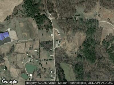
Map
Nearby Homes
- 106 Amby Ln
- 903 Porter Rd
- 13917 Ohio 554
- 9675 Ohio 554
- 0 Porter Rd
- 10811 State Route 554
- 25 Hudson Rd
- 7669 Bull Run Rd
- 0 Keesee Rd Unit 1817733
- 31166 Edmundson Rd
- 31198 Edmundson Rd
- 31542 Metheny Fairplay Rd
- 754 Prospect Church Rd
- 30745 Ohio 325
- 0 Edmundson Rd Unit (Tract 5 at Big Timb
- 0 Edmundson Rd Unit (Tract 7 at Big Timb
- 0 Edmundson Rd Unit (Tract 4 at Big Timb
- 0 Edmundson Rd Unit 2429533
- 92 Greentree Rd
- 0 Will Vance Rd