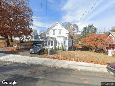
467 Lowell St Lawrence, MA 01841
Tower Hill NeighborhoodEstimated Value: $541,264 - $744,000
4
Beds
3
Baths
2,714
Sq Ft
$228/Sq Ft
Est. Value
About This Home
This home is located at 467 Lowell St, Lawrence, MA 01841 and is currently estimated at $619,066, approximately $228 per square foot. 467 Lowell St is a home located in Essex County with nearby schools including James F. Hennessey School, Alexander B. Bruce School, and School For Exceptional Studies.
Ownership History
Date
Name
Owned For
Owner Type
Purchase Details
Closed on
Jul 12, 2010
Sold by
Polanco Zoila C
Bought by
Polanco Eleuterio and Polanco Ziola C
Current Estimated Value
Purchase Details
Closed on
Jun 30, 1992
Sold by
Decocq Richard F
Bought by
Polanco Zoila C
Home Financials for this Owner
Home Financials are based on the most recent Mortgage that was taken out on this home.
Original Mortgage
$72,650
Interest Rate
8.57%
Mortgage Type
Purchase Money Mortgage
Create a Home Valuation Report for This Property
The Home Valuation Report is an in-depth analysis detailing your home's value as well as a comparison with similar homes in the area
Home Values in the Area
Average Home Value in this Area
Purchase History
| Date | Buyer | Sale Price | Title Company |
|---|---|---|---|
| Polanco Eleuterio | -- | -- | |
| Polanco Zoila C | $72,500 | -- |
Source: Public Records
Mortgage History
| Date | Status | Borrower | Loan Amount |
|---|---|---|---|
| Open | Polanco Zoila C | $140,000 | |
| Previous Owner | Polanco Zoila C | $40,000 | |
| Previous Owner | Polanco Zoila C | $72,650 |
Source: Public Records
Tax History Compared to Growth
Tax History
| Year | Tax Paid | Tax Assessment Tax Assessment Total Assessment is a certain percentage of the fair market value that is determined by local assessors to be the total taxable value of land and additions on the property. | Land | Improvement |
|---|---|---|---|---|
| 2025 | $4,845 | $550,600 | $147,800 | $402,800 |
| 2024 | $4,533 | $490,100 | $142,800 | $347,300 |
| 2023 | $4,436 | $436,600 | $125,000 | $311,600 |
| 2022 | $4,144 | $362,200 | $116,200 | $246,000 |
| 2021 | $3,991 | $325,300 | $116,200 | $209,100 |
| 2020 | $3,823 | $307,600 | $98,500 | $209,100 |
| 2019 | $3,633 | $265,600 | $85,300 | $180,300 |
| 2018 | $3,308 | $231,000 | $81,500 | $149,500 |
| 2017 | $3,140 | $204,700 | $78,700 | $126,000 |
| 2016 | $2,942 | $189,700 | $55,900 | $133,800 |
| 2015 | $2,868 | $189,700 | $55,900 | $133,800 |
Source: Public Records
Map
Nearby Homes
- 34-38 Milton St
- 128 Butler St Unit 128
- 550 Haverhill St
- 49 Shawmut St
- 48 Greenwood St
- 22 School St
- 5 Bodwell St
- 7 Forest St
- 5 Magnolia St
- 367-369 W Lowell St
- 55-59 Water St
- 218 Water St
- 40 Cypress Ave
- 47 Hallenan Ave
- 439-443 Riverside Dr
- 1150 Essex St
- 83 Cross St
- 31 Strathmore Rd
- 44 Glen Ave
- 37 Tewksbury St Unit 39