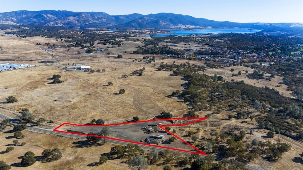
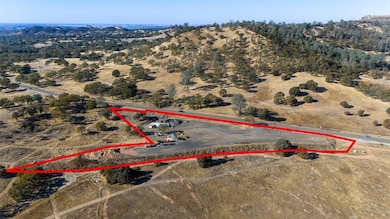


470 Highway 12 Valley Springs, CA 95252
Estimated payment $8,472/month
Highlights
- Panoramic View
- No HOA
- Grass Covered Lot
About This Lot
Located in the heart of historic Valley Springs, '470 CA-12' is a multipurpose 4.11-acre commercial property in Calaveras County. This versatile multiple-parcel offering includes a water well, excellent wide frontage and a prime location near the town center. Situated along CA-12 near the CA-26 intersection, the highly visible property is along the well traveled route to and from the Central Valley and Foothills to the Sierra Nevada. The property is nearly completely flat and ready for development. There is an approximate 180' deep water well near the northeast side of the property. The land is surrounded by the beautiful oak tree studded rolling hills of the Mother Lode in the heart of historic and vibrant Gold Country. A highly desirable wide and visible frontage along CA-12 is optimal for commercial development, including a variety of other permitted uses for the favorable zoning provided this property. Valley Springs and the neighboring communities in Calaveras and Stanislaus County offer year-round residents and visitors exceptional climate and weather. Valley Springs is at the heart of the Gold Country area in Calaveras County and serves as a hub of activity and resources for the region. The town is centrally located at the intersection of CA-26 and CA-12.
Property Details
Property Type
- Land
Est. Annual Taxes
- $1,198
Lot Details
- 4.11 Acre Lot
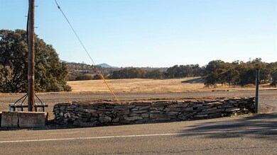
- Property fronts a highway
- Corners Of The Lot Have Been Marked
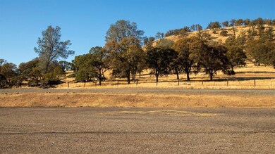
- Few Trees
- Grass Covered Lot
- Possible uses of the property include Residential, Commercial, See Remarks, Other
- Property is zoned Commercial w Res OK w CUP, Commercial,Residential,Mixed,See Remarks
Property Views
- Panoramic
- Downtown
- Woods
- Mountain
- Hills
- Valley
Community Details
- No Home Owners Association
- Net Lease
Listing and Financial Details
- Assessor Parcel Number 046-016-075
Map
Home Values in the Area
Average Home Value in this Area
Tax History
| Year | Tax Paid | Tax Assessment Tax Assessment Total Assessment is a certain percentage of the fair market value that is determined by local assessors to be the total taxable value of land and additions on the property. | Land | Improvement |
|---|---|---|---|---|
| 2023 | $1,198 | $109,261 | $109,261 | $0 |
| 2022 | $1,223 | $107,119 | $107,119 | $0 |
| 2021 | $1,123 | $105,019 | $105,019 | $0 |
| 2020 | $1,144 | $103,943 | $103,943 | $0 |
| 2019 | $1,185 | $101,905 | $101,905 | $0 |
| 2018 | $1,132 | $99,907 | $99,907 | $0 |
| 2017 | $1,107 | $97,949 | $97,949 | $0 |
| 2016 | $1,106 | $96,029 | $96,029 | $0 |
| 2015 | -- | $94,587 | $94,587 | $0 |
| 2014 | -- | $92,735 | $92,735 | $0 |
Property History
| Date | Event | Price | Change | Sq Ft Price |
|---|---|---|---|---|
| 01/05/2024 01/05/24 | For Sale | $1,500,000 | -- | -- |
Source: MetroList
MLS Number: 224001707
APN: 046-016-075-000
Disclaimer: Certain information contained herein is derived from information provided by parties other than Homes.com. All information provided is deemed reliable, but is not guaranteed to be accurate and should be independently verified.
![]() IDX information is provided exclusively for personal, non-commercial use, and may not be used for any purpose other than to identify prospective properties consumers may be interested in purchasing. Information is deemed reliable but not guaranteed.
IDX information is provided exclusively for personal, non-commercial use, and may not be used for any purpose other than to identify prospective properties consumers may be interested in purchasing. Information is deemed reliable but not guaranteed.
- 5701 W Highway 12
- 0 Lime Creek Rd
- 247 W Highway 12 Unit 13
- 271 E Daphne St
- 138 E Daphne St
- 3109 State Route 26
- 2253 State Route 26
- 0 Highway 12 Hwy Unit 224152531
- 0 Highway 12 Hwy Unit 202402096
- 0 Highway 12 Hwy Unit 224107440
- 82 E Daphne St
- 329 Sequoia Ave Unit SP 32
- 329 Sequoia Ave Unit 6
- 78 E Highway 12
- 94 E Highway 12
- 157 Sequoia Ave
- 159 E Daphne St
- 5805 State Route 26
- 762 State Route 26
- 1943 S Ranchero Rd
