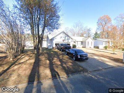
4705 Robinwood Dr Chattanooga, TN 37416
Bonny Oaks-Highway 58 NeighborhoodEstimated Value: $336,000 - $379,000
3
Beds
2
Baths
2,100
Sq Ft
$168/Sq Ft
Est. Value
About This Home
This home is located at 4705 Robinwood Dr, Chattanooga, TN 37416 and is currently estimated at $353,476, approximately $168 per square foot. 4705 Robinwood Dr is a home located in Hamilton County with nearby schools including Harrison Elementary School, Brown Middle School, and Central High School.
Ownership History
Date
Name
Owned For
Owner Type
Purchase Details
Closed on
Oct 24, 2008
Sold by
Reel Wayne C and Davis Reel Gwen D
Bought by
Reel Wayne C and Davis Reel Gwen D
Current Estimated Value
Purchase Details
Closed on
Jul 21, 2005
Sold by
Ballard Jeffrey J and Ballard Trinette
Bought by
Reel Wayne C and Davis Gwen D
Home Financials for this Owner
Home Financials are based on the most recent Mortgage that was taken out on this home.
Original Mortgage
$161,466
Interest Rate
5.46%
Mortgage Type
FHA
Purchase Details
Closed on
Apr 30, 1999
Sold by
Nabors David R and Nabors Peggy H
Bought by
Ballard Jeffrey J and Ballard Trinette
Home Financials for this Owner
Home Financials are based on the most recent Mortgage that was taken out on this home.
Original Mortgage
$106,800
Interest Rate
6.87%
Create a Home Valuation Report for This Property
The Home Valuation Report is an in-depth analysis detailing your home's value as well as a comparison with similar homes in the area
Home Values in the Area
Average Home Value in this Area
Purchase History
| Date | Buyer | Sale Price | Title Company |
|---|---|---|---|
| Reel Wayne C | -- | None Available | |
| Reel Wayne C | $164,000 | Milligan Reynolds Guaranty T | |
| Ballard Jeffrey J | $14,000 | -- |
Source: Public Records
Mortgage History
| Date | Status | Borrower | Loan Amount |
|---|---|---|---|
| Open | Reel Wayne C | $166,000 | |
| Closed | Reel Wayne C | $15,494 | |
| Closed | Reel Wayne C | $161,466 | |
| Previous Owner | Ballard Jeffrey Jerome | $138,000 | |
| Previous Owner | Ballard Jeffrey J | $106,800 |
Source: Public Records
Tax History Compared to Growth
Tax History
| Year | Tax Paid | Tax Assessment Tax Assessment Total Assessment is a certain percentage of the fair market value that is determined by local assessors to be the total taxable value of land and additions on the property. | Land | Improvement |
|---|---|---|---|---|
| 2024 | $1,453 | $64,950 | $0 | $0 |
| 2023 | $1,453 | $64,950 | $0 | $0 |
| 2022 | $1,453 | $64,950 | $0 | $0 |
| 2021 | $1,453 | $64,950 | $0 | $0 |
| 2020 | $1,201 | $43,425 | $0 | $0 |
| 2019 | $1,201 | $43,425 | $0 | $0 |
| 2018 | $1,115 | $43,425 | $0 | $0 |
| 2017 | $1,201 | $43,425 | $0 | $0 |
| 2016 | $1,086 | $0 | $0 | $0 |
| 2015 | $2,108 | $39,275 | $0 | $0 |
| 2014 | $2,108 | $0 | $0 | $0 |
Source: Public Records
Map
Nearby Homes
- 4719 Lake Hills Cir
- 4735 Lake Hills Cir
- 4831 Bonny Lake Ln
- 4420 Short St
- 4630 Jersey Pike
- 4209 Willard Dr
- 4659 Heiskell Dr
- 4646 Heiskell Dr
- 4654 Heiskell Dr
- 6202 Stockton Dr
- 4399 Byrd Ave
- 0 Bonny Oaks Dr Unit 1505693
- 0 Oakwood Dr Unit 1509231
- 3902 Rosalind Ln
- 4609 Tarpon Trail
- 6307 Bonny Oaks Dr
- 0 Chickamauga Ave
- 6323 Hansley Dr Unit 1
- 3990 Arbor Place Ln
- 4842 Glenmar Cir