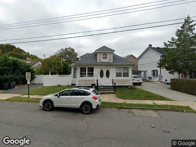
476 Brighton Ave Long Branch, NJ 07740
West End NeighborhoodEstimated Value: $537,000 - $961,000
2
Beds
1
Bath
888
Sq Ft
$759/Sq Ft
Est. Value
About This Home
This home is located at 476 Brighton Ave, Long Branch, NJ 07740 and is currently estimated at $673,715, approximately $758 per square foot. 476 Brighton Ave is a home located in Monmouth County with nearby schools including Long Branch High School, Holy Trinity School, and Bet Yaakov of the Jersey Shore.
Ownership History
Date
Name
Owned For
Owner Type
Purchase Details
Closed on
Jul 22, 1999
Sold by
Yacubovich Robert
Bought by
Karpus John and Karpus Lisa
Current Estimated Value
Home Financials for this Owner
Home Financials are based on the most recent Mortgage that was taken out on this home.
Original Mortgage
$115,000
Interest Rate
7.83%
Mortgage Type
Purchase Money Mortgage
Create a Home Valuation Report for This Property
The Home Valuation Report is an in-depth analysis detailing your home's value as well as a comparison with similar homes in the area
Home Values in the Area
Average Home Value in this Area
Purchase History
| Date | Buyer | Sale Price | Title Company |
|---|---|---|---|
| Karpus John | $125,000 | -- |
Source: Public Records
Mortgage History
| Date | Status | Borrower | Loan Amount |
|---|---|---|---|
| Open | Karpus John F | $191,000 | |
| Closed | Karpus John F | $80,000 | |
| Previous Owner | Karpus John | $115,000 |
Source: Public Records
Tax History Compared to Growth
Tax History
| Year | Tax Paid | Tax Assessment Tax Assessment Total Assessment is a certain percentage of the fair market value that is determined by local assessors to be the total taxable value of land and additions on the property. | Land | Improvement |
|---|---|---|---|---|
| 2024 | $7,476 | $544,300 | $370,000 | $174,300 |
| 2023 | $7,476 | $481,400 | $315,000 | $166,400 |
| 2022 | $5,359 | $357,300 | $210,700 | $146,600 |
| 2021 | $5,359 | $267,800 | $130,700 | $137,100 |
| 2020 | $5,518 | $264,000 | $127,700 | $136,300 |
| 2019 | $5,310 | $252,600 | $122,700 | $129,900 |
| 2018 | $5,346 | $252,900 | $127,700 | $125,200 |
| 2017 | $5,019 | $243,500 | $120,700 | $122,800 |
| 2016 | $4,958 | $245,300 | $125,700 | $119,600 |
| 2015 | $4,271 | $191,800 | $50,300 | $141,500 |
| 2014 | $3,996 | $189,100 | $63,500 | $125,600 |
Source: Public Records
Map
Nearby Homes
- 264 Norwood Ave
- 313 Norwood Ave
- 458 W End Ave
- 17 Mitchell Terrace
- 564 Monmouth Place
- 6 Hawks Way
- 387 Brighton Ave
- 369 Norwood Ave
- 207 Oakwood Ave
- 56 Wall St
- 552 Westwood Ave
- 518 Westwood Ave
- 388 Brookdale Ave
- 511 Westwood Ave
- 351 Hollywood Ave
- 487 Westwood Ave
- 495 Westwood Ave
- 86 Wall St
- 467 Monmouth Place
- 448 Monmouth Place