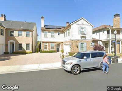
4821 Coveview Dr Huntington Beach, CA 92649
Estimated Value: $1,806,945 - $1,982,000
4
Beds
3
Baths
2,200
Sq Ft
$875/Sq Ft
Est. Value
About This Home
This home is located at 4821 Coveview Dr, Huntington Beach, CA 92649 and is currently estimated at $1,925,736, approximately $875 per square foot. 4821 Coveview Dr is a home located in Orange County with nearby schools including Hope View Elementary School, Mesa View Middle School, and Huntington Beach High School.
Ownership History
Date
Name
Owned For
Owner Type
Purchase Details
Closed on
Nov 25, 2013
Sold by
Dirty Martini Llc
Bought by
Magnotta Robert and Magnotta Nicole
Current Estimated Value
Purchase Details
Closed on
Dec 24, 2009
Sold by
Cafiero Constance T
Bought by
Dirty Martini Llc
Purchase Details
Closed on
Mar 6, 2008
Sold by
Cafiero Constance
Bought by
Cafiero Constance T and Constance T Cafiero Family Trust
Purchase Details
Closed on
Dec 19, 2007
Sold by
Signal Landmark
Bought by
Cafiero Constance
Home Financials for this Owner
Home Financials are based on the most recent Mortgage that was taken out on this home.
Original Mortgage
$1,000,000
Interest Rate
6%
Mortgage Type
Purchase Money Mortgage
Create a Home Valuation Report for This Property
The Home Valuation Report is an in-depth analysis detailing your home's value as well as a comparison with similar homes in the area
Home Values in the Area
Average Home Value in this Area
Purchase History
| Date | Buyer | Sale Price | Title Company |
|---|---|---|---|
| Magnotta Robert | -- | Accommodation | |
| Dirty Martini Llc | -- | Accommodation | |
| Cafiero Constance T | -- | None Available | |
| Cafiero Constance | $1,333,000 | Fidelity National Title |
Source: Public Records
Mortgage History
| Date | Status | Borrower | Loan Amount |
|---|---|---|---|
| Previous Owner | Cafiero Constance | $1,000,000 | |
| Previous Owner | Cafiero Constance | $199,700 |
Source: Public Records
Tax History Compared to Growth
Tax History
| Year | Tax Paid | Tax Assessment Tax Assessment Total Assessment is a certain percentage of the fair market value that is determined by local assessors to be the total taxable value of land and additions on the property. | Land | Improvement |
|---|---|---|---|---|
| 2024 | $14,791 | $1,314,798 | $688,443 | $626,355 |
| 2023 | $14,461 | $1,289,018 | $674,944 | $614,074 |
| 2022 | $14,257 | $1,263,744 | $661,710 | $602,034 |
| 2021 | $13,994 | $1,238,965 | $648,735 | $590,230 |
| 2020 | $13,839 | $1,226,261 | $642,083 | $584,178 |
| 2019 | $13,592 | $1,202,217 | $629,493 | $572,724 |
| 2018 | $13,284 | $1,178,645 | $617,150 | $561,495 |
| 2017 | $13,072 | $1,155,535 | $605,049 | $550,486 |
| 2016 | $12,472 | $1,127,942 | $593,185 | $534,757 |
| 2015 | $12,283 | $1,111,000 | $593,000 | $518,000 |
| 2014 | $10,009 | $1,089,060 | $570,241 | $518,819 |
Source: Public Records
Map
Nearby Homes
- 17272 Tidalridge Ln
- 4761 Edgartown Dr
- 17212 Lynn Ln
- 4651 Los Patos Ave
- 17495 Oakbluffs Ln
- 4621 Winthrop Dr
- 4682 Warner Ave Unit A204
- 5096 Tortuga Dr Unit 212
- 5101 Tortuga Dr Unit 205
- 5145 Tortuga Dr Unit 101
- 16972 Lynn Ln
- 4461 Los Patos Ave
- 17202 Corbina Ln Unit 110
- 4561 Warner Ave Unit 202
- 16861 Green Ln
- 17041 Malta Cir
- 17181 Westport Dr
- 17179 Roundhill Dr
- 5262 Glenroy Dr
- 4591 Warner Ave Unit 101