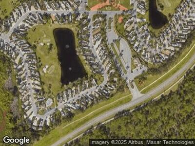
493 NW Boundary Dr Port St. Lucie, FL 34986
Saint Lucie West NeighborhoodEstimated Value: $305,214 - $327,000
--
Bed
--
Bath
--
Sq Ft
3,049
Sq Ft Lot
About This Home
This home is located at 493 NW Boundary Dr, Port St. Lucie, FL 34986 and is currently estimated at $316,107. 493 NW Boundary Dr is a home located in St. Lucie County with nearby schools including West Gate K-8 School, Oak Hammock K-8 School, and Bayshore Elementary School.
Ownership History
Date
Name
Owned For
Owner Type
Purchase Details
Closed on
Apr 18, 2018
Sold by
Clark Jeffrey G and Donfrio Ronald Donfrio
Bought by
Miller Ted M and Miller Ted M Trust
Current Estimated Value
Home Financials for this Owner
Home Financials are based on the most recent Mortgage that was taken out on this home.
Interest Rate
4.42%
Purchase Details
Closed on
Feb 9, 2016
Sold by
Aztec Rv Resort Inc
Bought by
Onfro Ronald D and Clark Jeffrey G
Purchase Details
Closed on
Apr 1, 2015
Sold by
Aztec Rv Management Inc
Bought by
Aztec R V Resort Inc
Purchase Details
Closed on
Mar 21, 2013
Sold by
Lane Properties I Lp
Bought by
Aztec Rv Management Inc
Purchase Details
Closed on
Feb 24, 2005
Sold by
Outdoor Resorts At St Lucie West Inc
Bought by
Lane Properties I Lp
Create a Home Valuation Report for This Property
The Home Valuation Report is an in-depth analysis detailing your home's value as well as a comparison with similar homes in the area
Home Values in the Area
Average Home Value in this Area
Purchase History
| Date | Buyer | Sale Price | Title Company |
|---|---|---|---|
| Miller Ted M | $125,000 | -- | |
| Onfro Ronald D | $105,000 | Fidelity Natl Title Fl Inc | |
| Aztec R V Resort Inc | $108,400 | Tri County Title & Escrow In | |
| Aztec Rv Management Inc | $107,500 | Attorney | |
| Lane Properties I Lp | $89,900 | -- |
Source: Public Records
Mortgage History
| Date | Status | Borrower | Loan Amount |
|---|---|---|---|
| Closed | Miller Ted M | -- |
Source: Public Records
Tax History Compared to Growth
Tax History
| Year | Tax Paid | Tax Assessment Tax Assessment Total Assessment is a certain percentage of the fair market value that is determined by local assessors to be the total taxable value of land and additions on the property. | Land | Improvement |
|---|---|---|---|---|
| 2024 | $4,154 | $230,200 | $206,900 | $23,300 |
| 2023 | $4,154 | $223,800 | $203,800 | $20,000 |
| 2022 | $3,802 | $199,100 | $179,100 | $20,000 |
| 2021 | $3,306 | $137,300 | $117,300 | $20,000 |
| 2020 | $2,971 | $104,700 | $89,700 | $15,000 |
| 2019 | $3,021 | $104,700 | $89,700 | $15,000 |
| 2018 | $2,680 | $97,700 | $82,700 | $15,000 |
| 2017 | $2,458 | $68,300 | $68,300 | $0 |
| 2016 | $2,232 | $73,300 | $68,300 | $5,000 |
| 2015 | $1,999 | $62,800 | $57,800 | $5,000 |
| 2014 | $1,914 | $62,800 | $0 | $0 |
Source: Public Records
Map
Nearby Homes
- 497 NW Boundary Dr
- 6 NW Boundary Dr
- 9 NW Boundary Dr
- 8 NW Boundary Dr
- 13 NW Boundary Dr
- 491 NW Boundary Dr
- 3 NW Boundary Dr
- 17 NW Boundary Dr
- 461 NW Sandtrap Ln
- 486 NW Boundary Dr
- 462 NW Sandtrap Ln
- 464 NW Sandtrap Ln
- 56 NW Boundary Dr
- 393 NW Boundary Dr
- 485 NW Boundary Dr
- 451 NW Sandtrap Ln
- 469 NW Sandtrap Ln
- 467 NW Sandtrap Ln
- 31 NW Boundary Dr
- 188 NW Hazard Way
