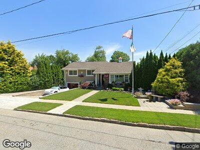
5 Bryant St Hartsdale, NY 10530
Hartsdale NeighborhoodEstimated Value: $708,000 - $850,000
3
Beds
2
Baths
1,590
Sq Ft
$485/Sq Ft
Est. Value
About This Home
This home is located at 5 Bryant St, Hartsdale, NY 10530 and is currently estimated at $771,625, approximately $485 per square foot. 5 Bryant St is a home located in Westchester County with nearby schools including Highview Elementary School, Richard J. Bailey Elementary School, and Lee F. Jackson Elementary School.
Ownership History
Date
Name
Owned For
Owner Type
Purchase Details
Closed on
Oct 14, 2022
Sold by
Mcgovern Gerard
Bought by
5 Bryant Street Realty Corp
Current Estimated Value
Purchase Details
Closed on
Jul 27, 2006
Sold by
Mcgovern Gerard
Bought by
Mcgovern Gerard and Jackson Noellen
Create a Home Valuation Report for This Property
The Home Valuation Report is an in-depth analysis detailing your home's value as well as a comparison with similar homes in the area
Home Values in the Area
Average Home Value in this Area
Purchase History
| Date | Buyer | Sale Price | Title Company |
|---|---|---|---|
| 5 Bryant Street Realty Corp | $750,000 | Great American Title | |
| Mcgovern Gerard | -- | None Available |
Source: Public Records
Mortgage History
| Date | Status | Borrower | Loan Amount |
|---|---|---|---|
| Previous Owner | Mcgovern Gerard | $303,000 | |
| Previous Owner | Mcgovern Gerard | $275,000 | |
| Previous Owner | Mcgovern Gerard | $320,000 |
Source: Public Records
Tax History Compared to Growth
Tax History
| Year | Tax Paid | Tax Assessment Tax Assessment Total Assessment is a certain percentage of the fair market value that is determined by local assessors to be the total taxable value of land and additions on the property. | Land | Improvement |
|---|---|---|---|---|
| 2024 | $12,306 | $727,400 | $228,700 | $498,700 |
| 2023 | $16,671 | $588,200 | $207,900 | $380,300 |
| 2022 | $13,976 | $562,400 | $207,900 | $354,500 |
| 2021 | $14,827 | $500,500 | $207,900 | $292,600 |
| 2020 | $13,945 | $480,200 | $207,900 | $272,300 |
| 2019 | $15,110 | $480,200 | $207,900 | $272,300 |
| 2018 | $13,389 | $471,400 | $207,900 | $263,500 |
| 2017 | $7,042 | $458,100 | $207,900 | $250,200 |
| 2016 | $233,064 | $440,500 | $207,900 | $232,600 |
| 2015 | -- | $15,450 | $1,900 | $13,550 |
| 2014 | -- | $15,450 | $1,900 | $13,550 |
| 2013 | $11,374 | $15,450 | $1,900 | $13,550 |
Source: Public Records
Map
Nearby Homes
- 29 Whittier St
- 320 W Hartsdale Ave
- 21 Stevenson Ave
- 38 Poe St
- 49 Chaucer St
- 113 Stone Oaks Dr
- 133 Stone Oaks Dr
- 19 Old Farm Ln
- 1 Edgewood Rd
- 14 Edgewood Rd
- 21 Edgewood Rd
- 445 Ridge Rd
- 183 W Hartsdale Ave
- 109 Ridge Rd
- 245 Lot 1 Secor Rd
- 245 Lot 2 Secor Rd
- 245 - Lot 3 Secor Rd
- 245 - Lot 4 Secor Rd
- 18 Dunham Rd
- 17 Bonnie Briar Rd